Understanding Open Access Land and What the Right to Roam Means
Many people know they can walk on public footpaths and rights of way, but fewer understand how open access land works or where they can legally leave the path and explore more freely. That’s where open access land comes in.
If you’ve ever looked across a moor, hillside or common and wondered whether you can wander beyond the footpath, understanding open access land can unlock new opportunities to explore the outdoors with confidence.
In this guide, we’ll explain what open access land is, how it differs from public rights of way, what the right to roam really means, and how to identify access land on an OS map.
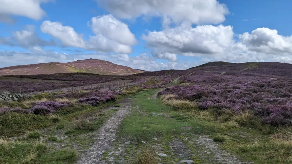
What is open access land?
Open access land is land where the public has a legal right to walk freely without having to stay on a marked footpath. In England and Wales, these rights were introduced through the Countryside and Rights of Way Act 2000, often shortened to the CROW Act. Open access land is typically:
- Mountain
- Moor
- Heath
- Downland
- Registered common land
Unlike a public footpath, which follows a defined route, open access land allows you to move freely within a designated area.
This means you can often leave the path to reach a summit, enjoy a viewpoint or explore the landscape more freely, while remaining within your legal access rights.
What does “right to roam” actually mean?
The phrase “right to roam” is widely used, but it can sometimes be misunderstood. In England and Wales, there is not a general right to walk across all private land. Instead, access rights apply to designated areas of open access land and to existing public rights of way.
In simple terms:
- You can walk along public footpaths, bridleways and other public rights of way.
- You can walk freely across designated open access land.
- You cannot automatically walk across private farmland, woodland or other private land unless a public right exists or permission has been granted.
This is why understanding access land and knowing how to find it on a map is so important for walkers. It helps you know where you can explore confidently and legally.

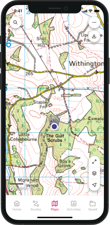
What does open access land look like on an OS map?
Open access land is shown on OS maps as a pale yellow or buff-coloured shaded area.
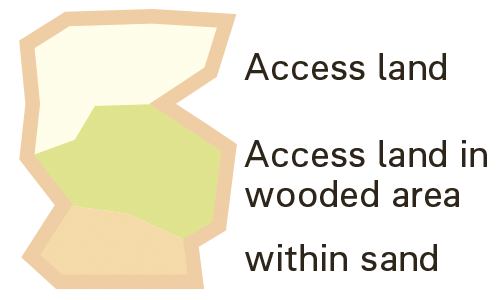
This is different from a public footpath, which appears as a coloured line. The line shows where you have the right to follow a route. The shaded area shows where wider access rights apply. When planning a walk, it’s important to look at both.
A common mistake is assuming that because you’re in open countryside or on a hill, you can walk wherever you like. In reality, access rights only apply within the mapped access land boundary.
Why the distinction matters
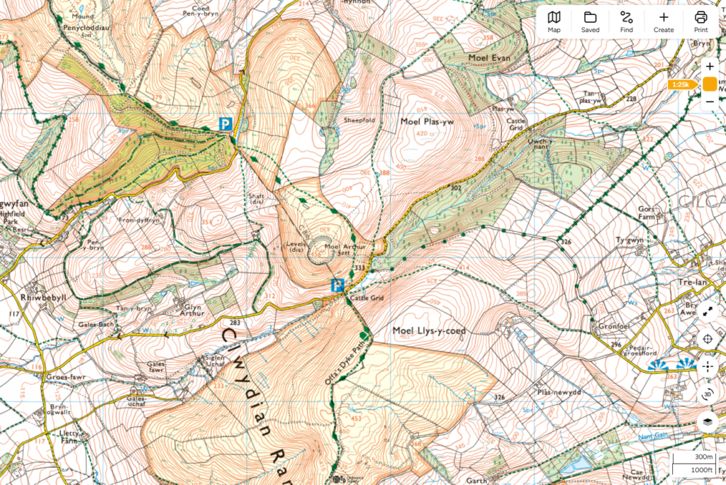
In the Clwydian Range in North Wales, some hills sit within extensive areas of open access land while neighbouring land may only have access along public rights of way. For example, the summit of Moel Plas-yw is not fully covered by the surrounding access land.
Without checking the map carefully, it would be easy to assume you could roam freely across the entire hillside but access rights do not automatically apply. This is why understanding access land boundaries is just as important as understanding footpaths.
This means you may be able to roam freely across one hillside but be restricted to a public footpath on another. Looking at the access land shading helps you understand exactly where those rights apply.
Are there places within access land where you still can’t go?
Even within a larger area of open access land, there may be places where access rights do not apply.
These can include farmyards, buildings, private gardens and other areas excluded from access rights.
This is another reason why it is important to read the map carefully and follow signs on the ground rather than assuming an entire hillside is open for exploration.
Why use an OS map instead of Google Maps?
One of the advantages of OS Maps is that access land is clearly shown on Explorer mapping at 1:25,000 scale. General mapping apps such as Google Maps can help you find a car park or navigate to a start point, but they do not clearly display open access land boundaries alongside public rights of way. Being able to see both together makes it much easier to answer two important questions before you set off:
Where can I explore?
Where can I walk?
How do I find open access land using OS Maps?
Finding access land is usually straightforward once you know what to look for:
- Choose an area to explore
Search for a hill, moor, common or area of open countryside. - Look for access land shading
Identify the pale yellow shaded areas on the map. - Check how to reach it
Follow public footpaths, bridleways or other access routes into the access land. - Plan beyond the path
Once on access land, you can often create more flexible routes by linking viewpoints, summits or landscape features rather than simply following a waymarked trail.
One of the biggest advantages of using OS Maps is being able to see both rights of way and open access land together. This helps you understand not just where you can walk, but where you can explore.
Is open access land the same as a public footpath?
No. This is one of the most common countryside access questions. A public footpath gives you the right to travel along a specific route. Open access land gives you the right to walk within a wider area. In many locations, a public footpath acts as a gateway onto a much larger area of open access land.
| Public footpath | Open access land |
|---|---|
| A defined route | A defined area |
| Follow the path | Explore within the boundary |
| Shown as a line on a map | Shown as a shaded area on a map |
| Access along a route | Access across a landscape |
Why do we have open access land?
For much of the twentieth century, some of Britain’s most dramatic landscapes were privately owned and largely inaccessible to the public. Many upland areas had public footpaths running through them, but walkers could not legally leave those routes to explore the surrounding hills, moorland and open countryside.
That began to change in 1932 when a group of walkers took part in the Kinder Scout mass trespass in the Peak District. At the time, access to large areas of moorland was heavily restricted, and campaigners argued that people should have greater access and the right to roam in the countryside.
The protest did not immediately change the law, but it became a powerful symbol of the movement for wider countryside access and the emergence of the first National Parks in England and Wales.
Historical fact
The Kinder Scout mass trespass took place in 1932, but the Countryside and Rights of Way Act 2000 was not passed until 2000. Nearly seventy years passed between the protest and the legislation that created modern access land rights.
The creation of National Parks helped protect some of Britain’s most important landscapes and improved opportunities for recreation, but it did not create a general right to roam. In many areas, walkers still had to stay on public footpaths. It wasn’t until the Countryside and Rights of Way Act 2000 that the public gained the right to walk freely across designated areas of mountain, moor, heath, downland and common land across England and Wales.
The pale yellow access land shading shown on OS maps is the modern result of decades of campaigning for greater access to the countryside.
Can you walk anywhere on open access land?
Usually, yes, within the access land boundary. You are not normally required to stay on a marked route once you are on designated access land. However, access rights are not unlimited.
Temporary restrictions may apply for:
- Wildlife conservation
- Ground nesting bird protection
- Land management activities
- Public safety reasons
You should always check local guidance before your walk.
What if there is livestock on open access land?
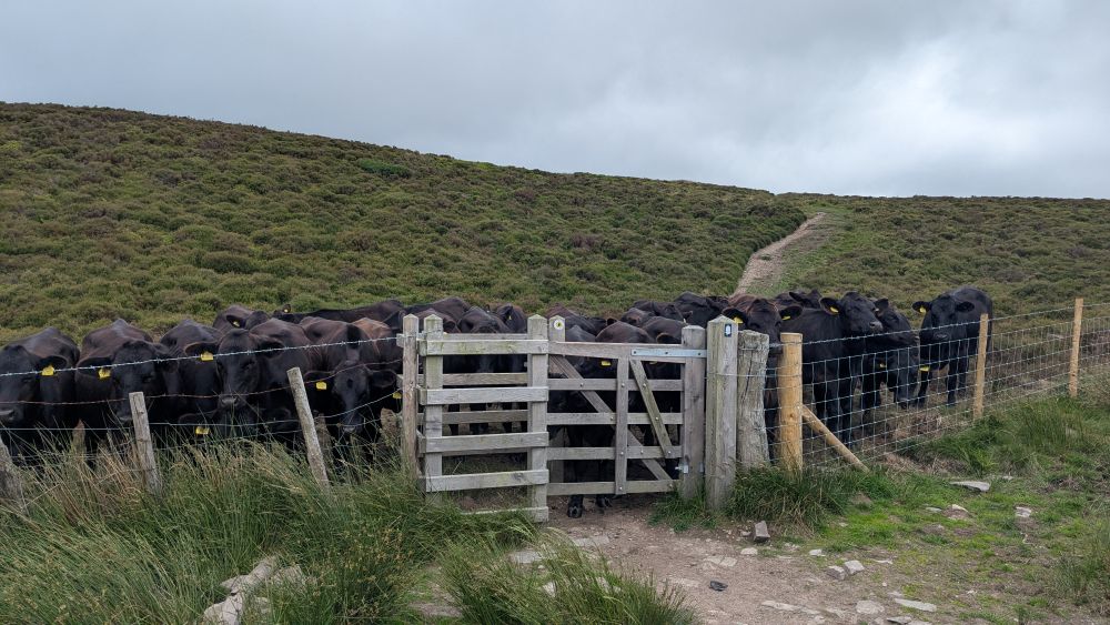
Seeing livestock on open access land can sometimes feel confusing. Many people assume that because access rights exist, they can walk anywhere without considering how the land is being used.
In reality, much of England and Wales’s access land is still working farmland. Sheep, cattle and ponies may all be present, particularly in upland areas.
You still have the right to access the land, but you should take extra care around animals and avoid causing disturbance.
Walking near livestock on access land
If livestock are present:
- Move calmly and predictably.
- Give animals as much space as possible.
- Avoid separating young animals from their mothers.
- Leave gates as you find them.
- Do not feed livestock.
Most animals will simply move away or ignore walkers, but it’s good practice to avoid walking directly through a herd of cows when an alternative route is available.
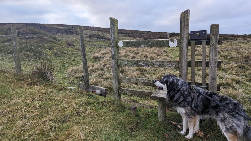
Walking with a dog
Dogs can cause stress to livestock, even if they are well behaved. If livestock are nearby:
- Keep your dog under close control.
- Use a lead where required by local signs or restrictions.
- Be particularly careful around sheep during lambing season.
If cattle approach and you feel threatened, the Countryside Code advises releasing your dog and moving away calmly. Your dog will usually run faster than cattle and can rejoin you once you are clear of the animals.
Access rights and farming go together
Open access land is not the same as a nature reserve or public park. Much of it is actively managed for farming, conservation and wildlife. The right to access this land was carefully balanced with the needs of farmers and landowners when the Countryside and Rights of Way Act 2000 was introduced. That’s why access rights come with responsibilities, including respecting livestock, following temporary restrictions and taking extra care when walking with dogs.
Respecting livestock helps protect farming livelihoods and supports continued access for everyone who enjoys exploring these landscapes.
What can you do on open access land?
Open access rights are intended for quiet recreation. Activities typically include:
- Walking
- Hiking
- Running
- Birdwatching
- Nature photography
- Picnicking
These rights allow visitors to enjoy landscapes without being restricted to a single path.
What can’t you do on open access land?
Open access land should not be confused with unrestricted access. Unless you have permission from the landowner activities that are generally not covered include:
- Cycling (off the path)
- Horse riding (off the Bridal Way)
- Driving vehicles (off the By Way)
- Camping
- Lighting fires
Additional local restrictions may also apply.
If you are planning a specialist activity or event, always ask the landowner or check access guidance for that specific area before visiting.
Are All Trig Pillars Accessible?
Not necessarily. Many walkers enjoy trig bagging, the challenge of visiting Ordnance Survey trig pillars across Britain. However, a trig pillar appearing on a map does not automatically mean you have the right to visit it.
Some trig pillars are located on open access land, while others sit beside public rights of way. Some, however, are on private land with no public access rights at all.
When planning a visit, it’s important to check:
- Whether the trig pillar sits within open access land
- Whether a public right of way reaches it
- Whether permission from the landowner is needed
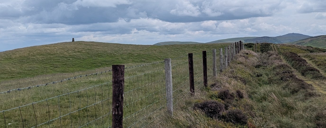
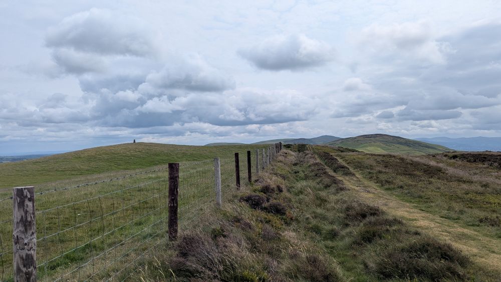
Inaccessible Trig Pillar Example: Moel y Parc, Clwydian Range
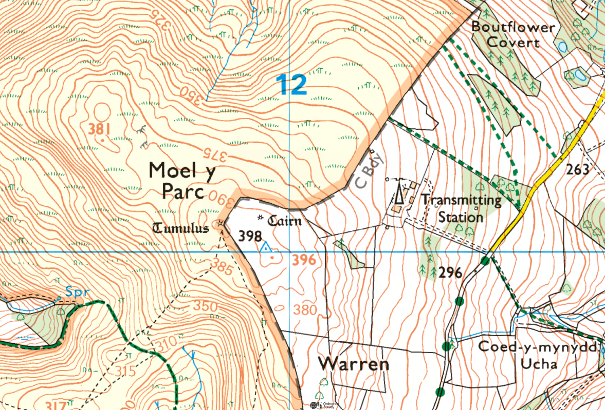
The trig pillar on Moel y Parc in the Clwydian Range provides a useful example. At first glance, the surrounding hillside appears to be open access land. However, a closer look at the map shows that the summit and trig pillar sit within a separate area outside the surrounding access land boundary.
This means that while walkers can enjoy the surrounding access land, reaching the trig pillar itself is not automatically covered by open access rights.
Check Before You Go
Before setting out to visit a trig pillar, ask:
- Is it on open access land?
- Does a public right of way reach it?
- Is permission required from the landowner?
Being able to see access land, rights of way and land boundaries together is one of the reasons detailed mapping is so valuable when planning a walk.
Frequently Asked Questions About Open Access Land
Open access land is land where the public has a legal right to walk freely without having to stay on a marked footpath. In England and Wales, this applies to designated areas such as mountain, moor, heath, downland and registered common land.
A public footpath is a legal route. Open access land is a designated area where you can walk more freely within its boundaries. Footpaths are shown as lines on a map, while access land is shown as a shaded area.
Yes. Once you are on designated open access land, you can usually leave the path and walk within the access land boundary, provided no restrictions apply.
Open access land appears as a pale yellow or buff-coloured shaded area on a 1:25k OS map. This shading marks the land where access rights apply.
Almost. Right to roam is the term commonly used to describe access rights on designated open access land in England and Wales. It does not mean you can walk across all private land.
You can generally move freely within the access land boundary, but restrictions can apply in certain locations or at certain times of year.
No. Access rights only apply to public rights of way and designated open access land. Most private farmland, woodland and residential land remains outside open access legislation.
Yes. Scotland has much broader access rights under separate legislation. Responsible access is permitted across most land and inland water, making Scotland’s system significantly different from that of England and Wales.
Usually yes, but dogs may need to be kept on a lead around livestock or during sensitive wildlife seasons. Always follow local guidance and read our guide for finding the best dog walks near you.
Not usually. Open access rights are primarily for walking and quiet recreation. Camping is not automatically included within open access rights in England and Wales. Read our guide to wild camping in England and Wales for more clarity on the legality of wild camping.
Yes. Access land can occasionally be closed or restricted for conservation, wildlife protection, land management or public safety reasons. Before visiting, check local notices and any guidance from the relevant authority.
No. The right of access to open access land does not include lighting fires or barbecues. If you want to light a fire, you would need the landowner’s permission and may also need to comply with any local restrictions. In practice, fires are strongly discouraged on access land because they can damage habitats and create a serious wildfire risk, particularly on moorland and heathland.
Yes. There is no general limit on the number of people who can walk together on open access land for recreational purposes. However, organised commercial events, guided walks and other paid-for activities are not automatically covered by access rights and may require permission from the landowner. If in doubt it’s best to check.
The easiest way is to use OS Maps and look for access land shading around hills, commons, moorland and upland areas. Many National Parks contain significant areas of open access land.
Key points to remember:
- Open access land gives you the legal right to walk beyond a marked path within designated areas of countryside.
- It is different from a public footpath, which follows a fixed route.
- On an OS map at scale 1:25K, open access land is shown as a pale yellow shaded area.
- The modern right to roam in England and Wales comes from the Countryside and Rights of Way Act 2000.
- Understanding access land can help you plan more varied and rewarding walks.
- Using OS Maps is one of the easiest ways to identify where these access rights apply before you set out
Learn More About Access and Navigation
Public Rights of Way Explained: Footpaths, Bridleways and Access Land
Learn what public rights of way are, where you can legally walk, cycle and ride, how to find public footpaths and bridleways, and what to do if a route is blocked.

Is Wild Camping Legal in England & Wales?
Is wild camping legal in England and Wales and can you get into trouble wild camping? Read our advice and wild camping code
Long Distance Footpaths: Discovering Britain’s ‘Diamond’ trails
How do you find the best footpath? Diamonds on OS maps mark named long-distance routes, highlighting footpaths are truly something special!
A Beginner’s Guide to OS Map Symbols
Learn how to read an OS map key with OS Maps Discover. Find out what common symbols mean for walking and cycling routes. Start with our simple guide.

A Beginner’s Guide to Using a Compass
How to read a compass, explained by OS Maps. Learn the basics of taking and following bearings with a map. Work through our beginner’s guide.
A Beginner’s Guide to Understanding Map Contour Lines
Contour lines explained by OS Maps. Learn how map contours show height, slopes, and the shape of the land before you plan a walk.
By Hilary Pullen
Meet Hilary, Editor of OS Maps Discover. Hilary is based in North Wales and loves hiking with her dogs in the mountains of Eryri and Bryniau Clwyd, you can find her on Instagram @nearlyuphill and read her guides to walking in North Wales.
If you would like to be a featured OS Author and write an article or route guide find out more here – how to submit an article idea