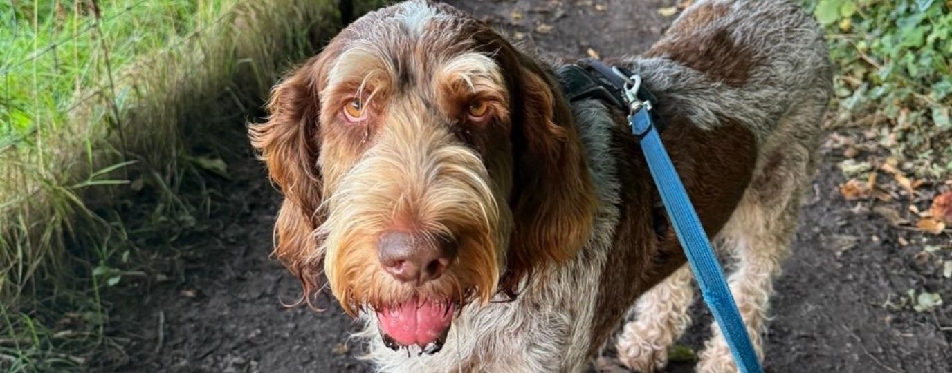
Looking for Dog Friendly Hikes?
Every dog enjoys the outdoors in a different way. Some love long climbs, other dogs can be tucked in a back pack or prefer gentle woodland paths. Some dogs are confident and safe off the lead around livestock, while others need space and quieter ground. No matter what distance your dog walk, OS Maps can help you find new, interesting routes for your dog walks.
Because no two dogs walk the same, the best way to find a safe and enjoyable dog friendly route is to choose one that matches your dog’s needs. So how do you find YOUR personally tailored dog friendly hikes? …the answer is OS Maps!
OS Maps is a must have for dog owners!
The OS Maps App gives you the detail to judge terrain, access, distance and any potential hazards before you set off. With a few simple filters, you can find routes that suit your dog’s confidence, energy level and the type of dog friendly walk you want to enjoy together. You can even learn how simple it is to create your own routes and share them with the hiking community.
The OS Maps app is a total game-changer for dog walking
If you follow me regularly @greatbritishdogwalks you’ll know I love exploring new places with my dog and I’m always on the lookout for tools that make planning and enjoying those walks easier. One app I rely on time and time again is the Ordnance Survey Maps app. Whether I’m heading off on a countryside trail or plotting a new coastal route, this app is a total game-changer.
Emily Gill OS Champion and founder of Great British Dog Walks
How to Use OS Maps to Find Dog Friendly Routes
OS Maps gives you many tools to judge whether a route is right for your dog. Here is how to use them in a practical way.
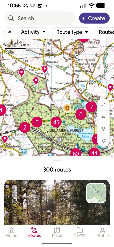
1. Start with the OS Maps Routes
Along the bottom of the screen you’ll find the option to search routes, enabling you to browse ready‑made walks. Many routes include full descriptions and helpful feedback and pictures from other walkers so do take a look at the reviews.
Make use of the filters to help you find routes from our recommended partners or browse thousands more routes created by our members. Useful filters include:
- Length and time of route
- Difficulty rating
- Star rating
- Circular or point to point
You can also sort results by popularity, distance or ascent to find exactly the right walk for you and your dog wherever you are in the UK.
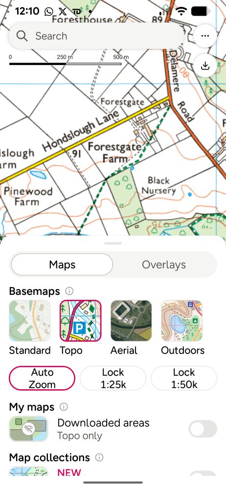
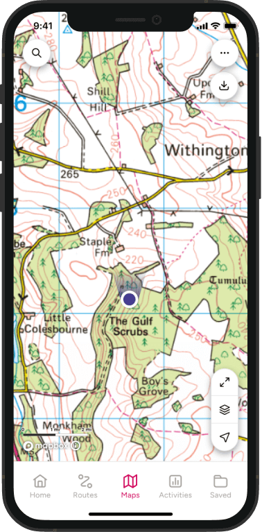
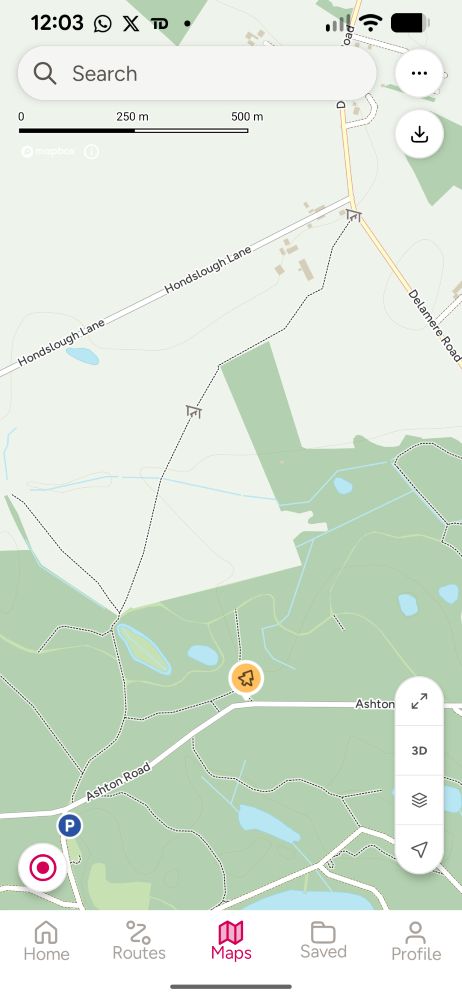
2. Check the Terrain Using OS Map Layers
Change the view to Topo or Aerial layers to find features that may impact or improve your dog walk such as:
- Field boundaries.
- Woodland areas.
- Water features such as streams, rivers and reservoirs
- Rights of way including footpaths, bridleways and permissive paths.
- Boggy or rocky ground
Use this view to see if the path crosses open countryside, farmland or moorland. This helps you judge where livestock may be present and where leads might be required.
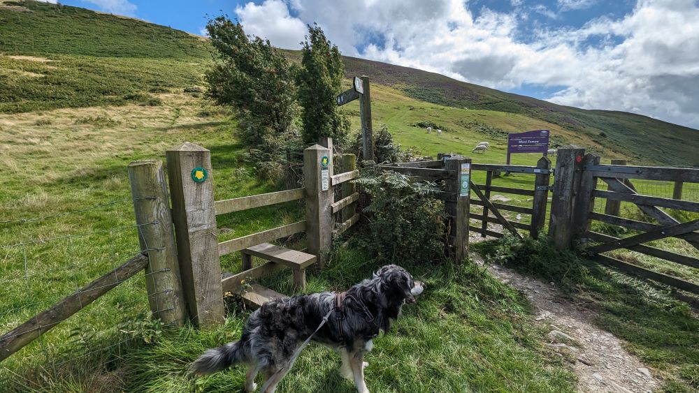
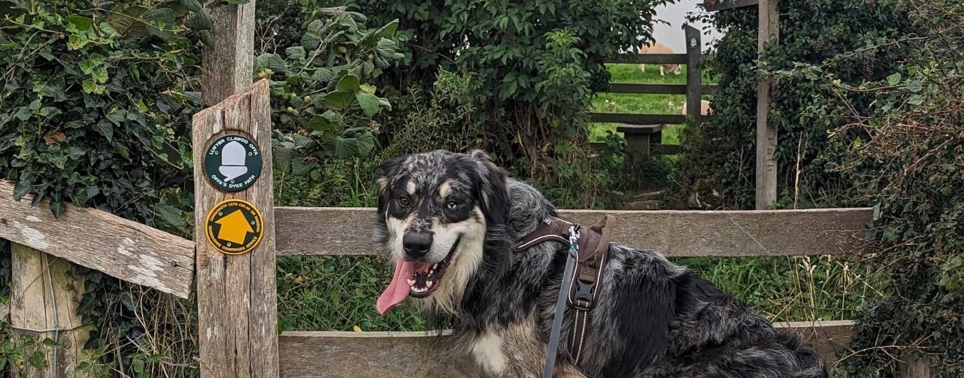
3. Worried about Stiles?
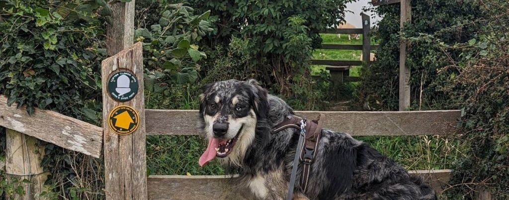
Zoom in to inspect features along the route you have chosen. If a stile appears, consider whether your dog can manage it. Some stiles include dog gates, but not all. A larger dog may need lifting, so choose a route that avoids these if needed. You’ll need to be in the standard layer to see stiles.
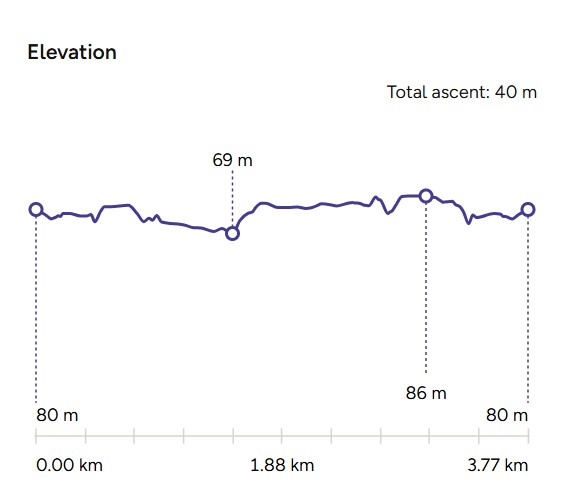
5. Check Steepness with Elevation Profiles
Open the elevation diagram on the route and check the steepness of your planned route. Older dogs or small breeds may struggle with steep climbs. Use the profile to choose gentle gradients and plan breaks. You can also try the amazing aerial view 3D Flythrough feature to really get an understanding of the elevation gain and terrain – it’s not just for moutnain routes – you can see any route in 3D Flythrough mode.
Practical Tips for Safe Dog Friendly Hiking
1. Plan for Livestock Safety
Livestock appear in many rural areas. Keep dogs on a short lead near farm animals.
If you expect grazing animals, choose lower‑risk routes through woodland, open access land or coastal paths without grazing. There are new dog laws in place to further protect livestock – don’t risk it if you’re not 100% sure there’s no livestock.
2. Bring Essentials for Your Dog
Pack:
- Water and a collapsible bowl.
- Poo bags.
- A towel for wet days.
- A spare lead.
- Treats for recall.
Short walks may only need the basics. Longer hikes require more planning to keep your dog safe. You can get really handy little bags to carry the essentials that even have waterproof compartments for keep smaelly dog bags secure and odour free while you continue your walk.
3. Check Seasonal Restrictions
Some areas have ground‑nesting birds in spring. They will usually have a notice on their social media pages or websites if it is a managed nature reserve or you may spot signs whilst on your walk. Be sure to follow the Countryside Code and make sure you keep dogs under close control in these areas.
Use OS Maps to choose alternative woodland or lowland routes during these periods.
4. Think About Weather and Comfort
- Hot days can be tough on dogs – especially large furry ones.
- Pick dog walking routes which have natural water sources.
- Choose shaded woodland routes and shorter distances.
- Cold or wet conditions may require a dog coat.
- Use OS Maps to identify routes with flexibility to shorten or lengthen them
How to Create Your Own Dog Friendly Route in OS Maps
If you prefer to design a route yourself, OS Maps makes it simple.
1. Plot a Safe Route Step by Step
Use the route‑plotting tool to find and follow footpaths, bridleways and quiet lanes. Toggle snp-to-path on for instant route creation from point to point, the app finds the path for you. Watch the above video for all the step by step instructions – it wont be long before you have a huge collection of your favourite dog walks.
2. Add Waypoints with Dog‑Specific Notes
As you are creating the route click to add and then edit waypoints.
Ideas for Waypoints to Mark on your dog walking routes
- Water stops.
- Potential livestock areas.
- Easy exit points if the weather changes.
- Possible shaded spots for breaks.
These waypoints will remind you what to expect when you are out on the ground.
3. Download for Offline Use
Save your finished route and download it. This ensures you have access to the map even when reception drops in rural areas.
Routes are private by default, however if you make it public you can share it with friends and other users can try it out and take advantage of your helpful tips.
If you’re looking for more dog walking tips, guides and inspiration then be sure to visit our growing hub of articles for dog walkers.
[wpcode id=”12338″]
Getting Outside with a Puppy: My Tips for Puppy Walking
Take your puppy on their first outdoor adventure, and learn the joy of walking through nature with your new best friend.
New Dog Laws – Livestock Worrying: What Dog Walkers Need to Know
New dog laws that protect livestock from sheep worrying and more. Keep your dog safe: Learn about the updated Dog Protection of Livestock Act
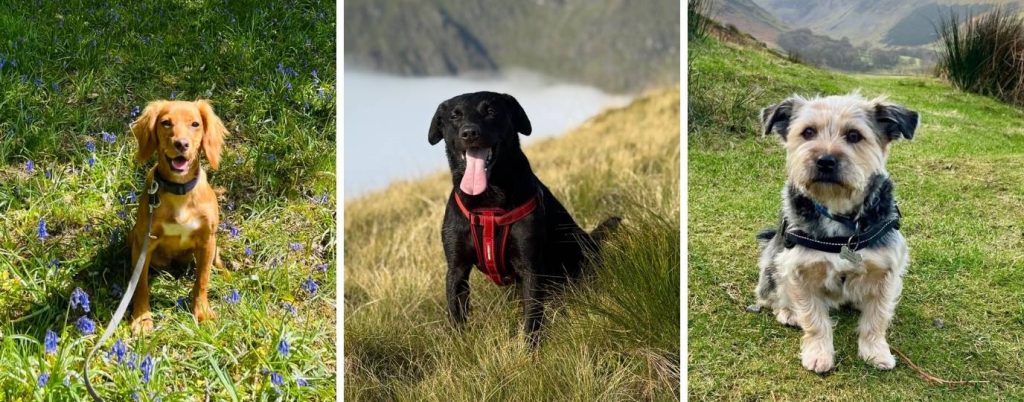
Which Breed of Dogs are Best for Hiking?
What dog breed is the best for hiking? OS Staff and Champions tell us all about their own hiking buddies and what they’re really like!