Britain’s Geographical Extremes: The Highest, Lowest, Wettest and Most Remarkable Places in Great Britain
From the highest mountain and longest cave system to the wettest valley and the point furthest from the sea, Great Britain is packed with remarkable geographical extremes. These record breaking locations reveal how geology, weather and landscape have shaped the places we explore today, while showcasing the extraordinary variety found across the country.
Where is the wettest place in Great Britain? Which location lies furthest from the sea? Where can you stand below sea level? Where are Britain’s highest cliffs, deepest waters and oldest rocks?
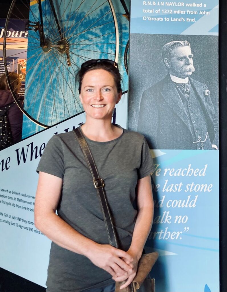
Inspired by a video documenting a journey to Britain’s four mainland compass points, I started wondering what other geographical records Great Britain holds. That curiosity felt especially fitting given my own family connection. My great grandfather, John Naylor, and his brother Robert Naylor were the first people to walk between the north eastern and south western extremities of Great Britain and document their journey as they visited fascinating places along the way. Victorian travel bloggers, no less.
From John O’Groats to Land’s End
“It was a big undertaking, especially as we had resolved not to journey by the shortest route, but to walk from one great object of interest to another, and to see and learn as much as possible of the country we passed through on our way. We were to walk the whole of the distance between the north-eastern extremity of Scotland and the south-western extremity of England, and not to cross a ferry or accept or take a ride in any kind of conveyance whatever. We were also to abstain from all intoxicating drink, not to smoke cigars or tobacco, and to walk so that at the end of the journey we should have maintained an average of twenty-five miles per day.” John Naylor
The Extremities of Britain
The four compass-point extremes of mainland Great Britain
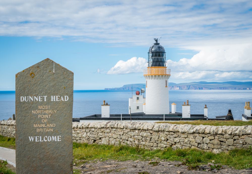
Furthest north: Dunnet Head, Caithness
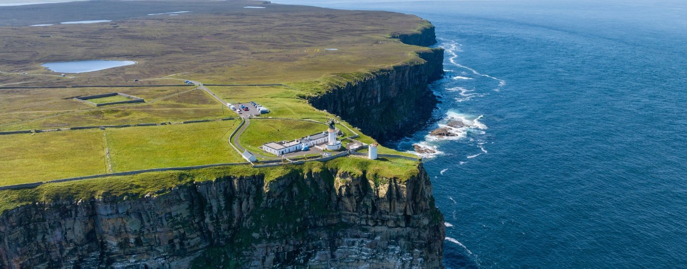
Many people assume John O’Groats is Britain’s northernmost mainland point. In reality, that title belongs to Dunnet Head in Caithness, which extends slightly further north into the Pentland Firth. John O’ Groats is actually the most North Easterly point.
Standing on the cliffs here, you’ll find spectacular views towards Orkney alongside thriving colonies of puffins, guillemots and kittiwakes. Why not plan a walk between these two iconic headlands.
Furthest south: Lizard Point, Cornwall
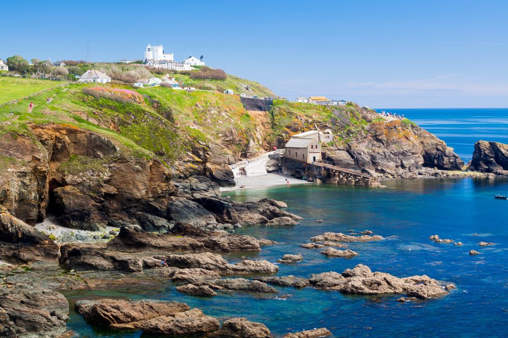
Mainland Britain’s southernmost point lies on the Lizard Peninsula in Cornwall.
Famous for its dramatic cliffs and distinctive serpentine geology, this stretch of coastline feels notably different from almost anywhere else in Britain. The South West Coast Path passes through the area, making it one of the most accessible geographical extremes to visit.
Furthest east: Ness Point, Suffolk
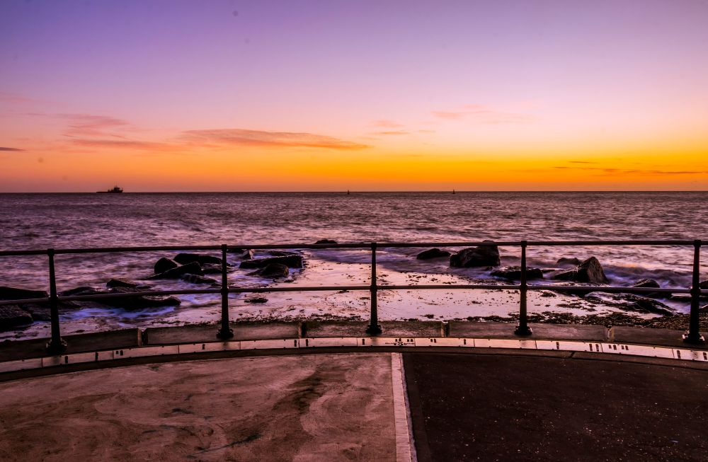
Ness Point in Lowestoft is the easternmost point of mainland Britain.
It is also often described as the first place in Britain to see the sunrise. A large compass sculpture marks the location and points towards destinations across Europe.
Furthest west: Corrachadh Mòr, Ardnamurchan
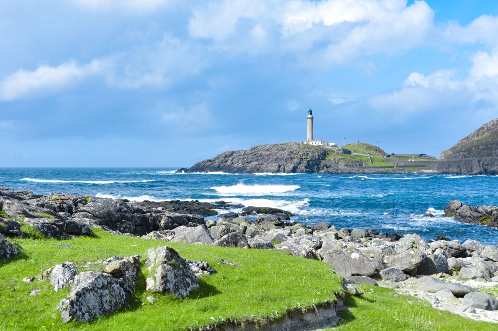
Remote, rugged and often overlooked, Corrachadh Mòr sits just south of Ardnamurchan Lighthouse on Scotland’s west coast.
Unlike the other compass points, reaching Britain’s westernmost mainland point requires a walk across rough coastal terrain. The effort is rewarded with a strong sense of remoteness and views across some of Scotland’s most dramatic coastal scenery.
If you have a fine day, there’s a lovely walk from Portuairk which travels through some of the finest scenery in Scotland to visit Ardnamurchan Lighthouse.
Britain’s highest point
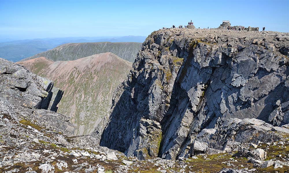
Ben Nevis, Highland
Towering above Fort William, Ben Nevis is the highest mountain in Great Britain and the British Isles, standing 1,345 metres above sea level. Around 125,000 walkers attempt the summit every year.
Its summit is the site of a former weather observatory, and the mountain’s notorious weather means cloud, wind and poor visibility are common even during summer.
Britain’s lowest point
Holme Fen, Cambridgeshire
Approx 5m below sea level
Hidden in the Cambridgeshire Fens is the lowest point in Great Britain.
At Holme Fen, a historic post records the dramatic subsidence that followed the draining of nearby Whittlesey Mere during the nineteenth century. The land has gradually sunk as peat soils dried and compressed, leaving today’s ground level around 5 metres below sea level.
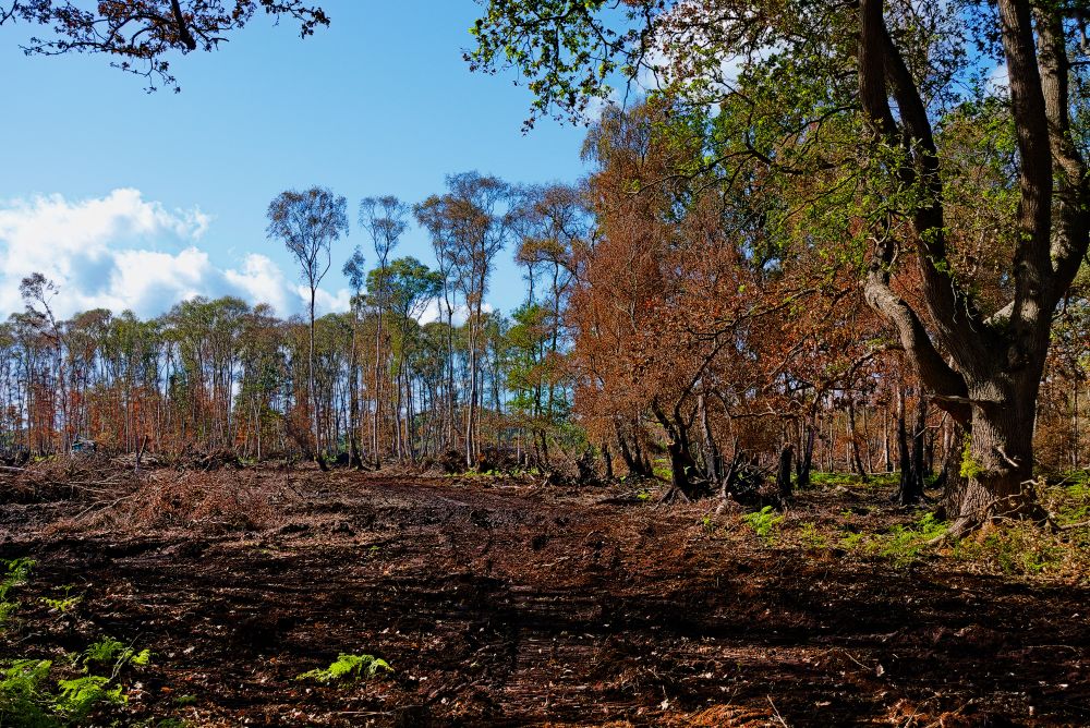
Unlike Ben Nevis, there is no summit cairn or dramatic viewpoint here. Instead, this is one of Britain’s most surprising geographical records.
However, the landscape made national headlines in Sepember 2026 when a major peat fire burned across Holme Fen during a period of exceptionally dry weather. As well as demonstrating the challenges facing lowland peat habitats, the fire highlighted how dramatically this landscape has changed since the Fens were drained in the nineteenth century.
Britain’s wettest inhabited place
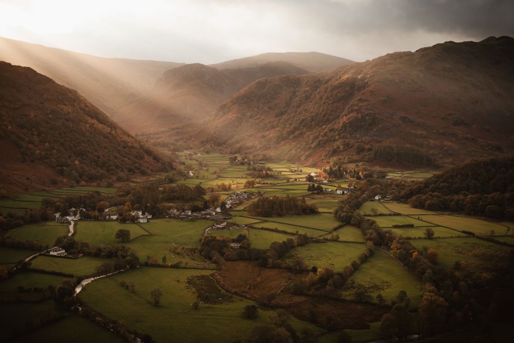
Seathwaite, Borrowdale, Cumbria
Tucked beneath some of England’s highest fells, Seathwaite is widely recognised as England’s wettest inhabited place. Surrounded by the mountains of Borrowdale, it regularly records more than 3,000mm of rainfall a year as moisture-laden Atlantic weather systems are forced upwards over the Lake District fells.
Where does the most rain fall in Great Britain?
Pinpointing the wettest place in Great Britain is surprisingly difficult. Rainfall varies from year to year, and the answer depends on whether you’re measuring a village, a weather station or a mountain summit. The highest totals are generally recorded in the mountains of Eryri (Snowdonia), the Lake District and the western Highlands of Scotland, where some locations receive more than 4,000mm of rain annually.
Britain’s driest region
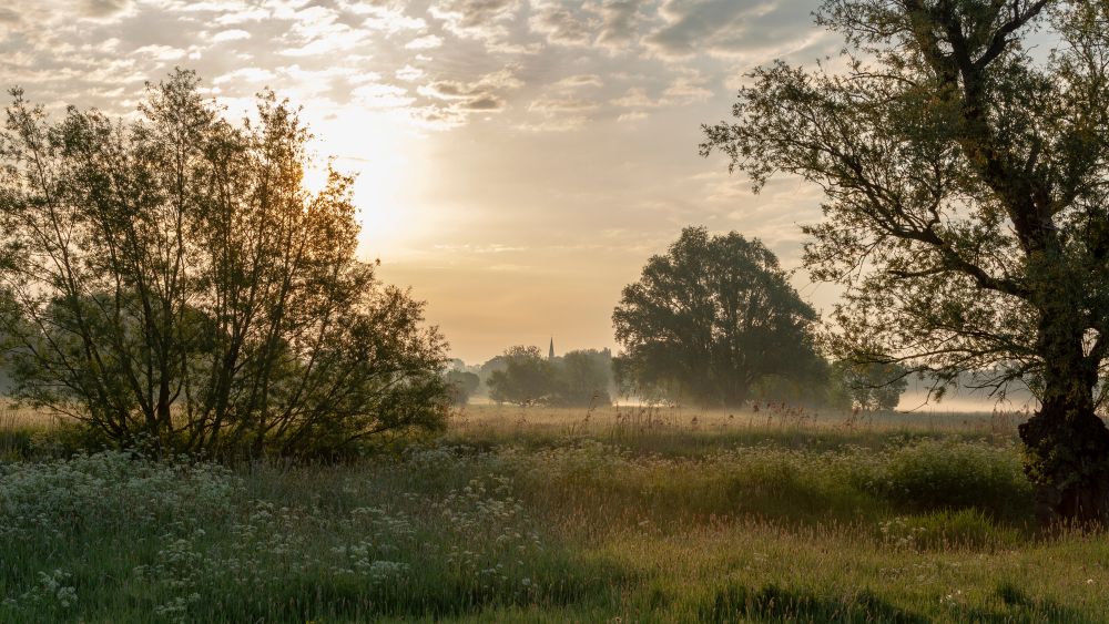
East Anglia
Britain’s driest climate is found in East Anglia, where parts of Essex, Suffolk and Cambridgeshire regularly record less than 600mm of rainfall each year. Sheltered from Atlantic weather systems by higher ground further west, the region’s relatively dry conditions have helped shape its distinctive landscapes of arable farmland, heathland and wetlands.
The contrast between Britain’s wettest and driest regions is remarkable. Some western mountain locations receive six times as much rainfall as parts of East Anglia.
The place furthest from the sea
Church Flatts Farm, Derbyshire
Despite Great Britain being an island, there is one location that lies further from the coast than anywhere else. Near Church Flatts Farm, close to the village of Coton in the Elms in Derbyshire, is Britain’s “pole of inaccessibility” – the point furthest from the sea.
According to calculations by Ordnance Survey, the location sits approximately 113km (70 miles) from the nearest coastline. It is almost equally distant from the Wash on England’s east coast and the Dee Estuary on the west.
Unlike many of Britain’s geographical extremes, there are no dramatic cliffs, mountain summits or famous landmarks here. Instead, this quiet patch of farmland holds one of the country’s most surprising geographical records.
Did you know?
Dunsop Bridge in the Forest of Bowland is often associated with the geographical centre of Great Britain, making it another fascinating destination for geography enthusiasts.
Britain’s highest waterfall
Eas a’ Chual Aluinn, Sutherland
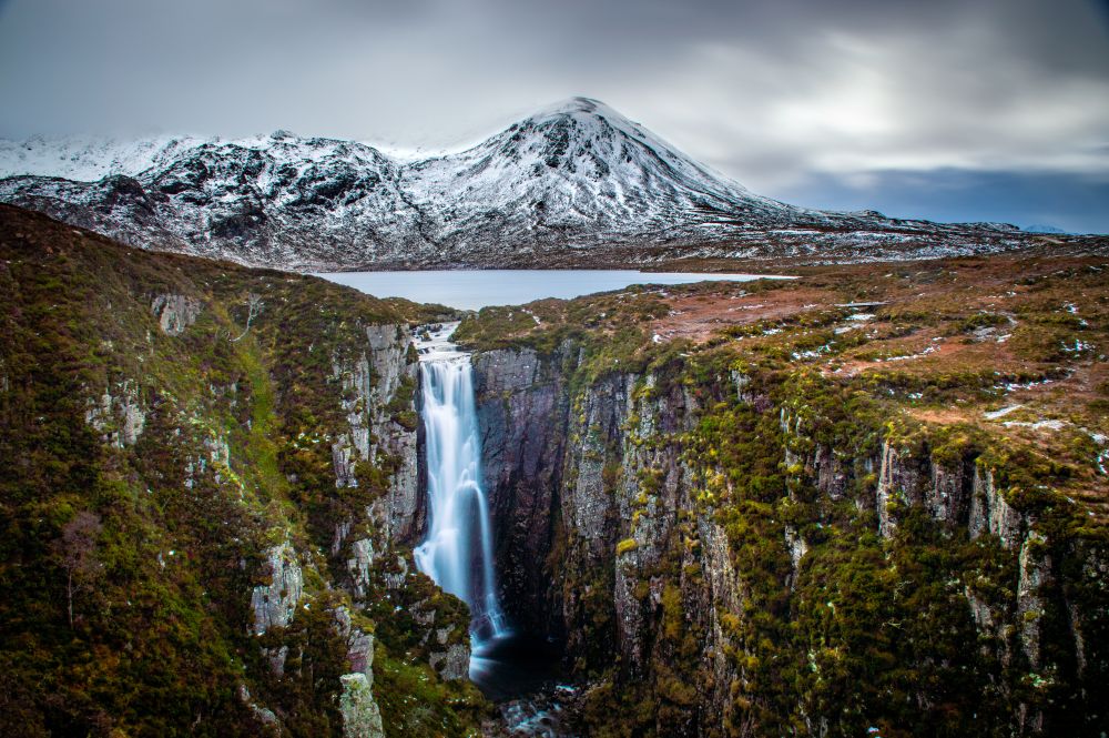
Hidden in the remote landscapes of Assynt in north west Scotland, Eas a’ Chual Aluinn is Britain’s highest waterfall. Known by some as The Wailing Widow, it plunges around 200 metres from the plateau above, making it more than three times the height of Niagara Falls.
Fed by Loch Glencoul, the waterfall drops into one of Scotland’s most dramatic glacial landscapes, surrounded by rugged mountains and sea lochs.
Despite holding the record, Eas a’ Chual Aluinn remains relatively unknown compared to better-known waterfalls such as High Force or Pistyll Rhaeadr. Reaching it requires a walk through remote terrain, adding to the sense of adventure.
Britain’s deepest lake
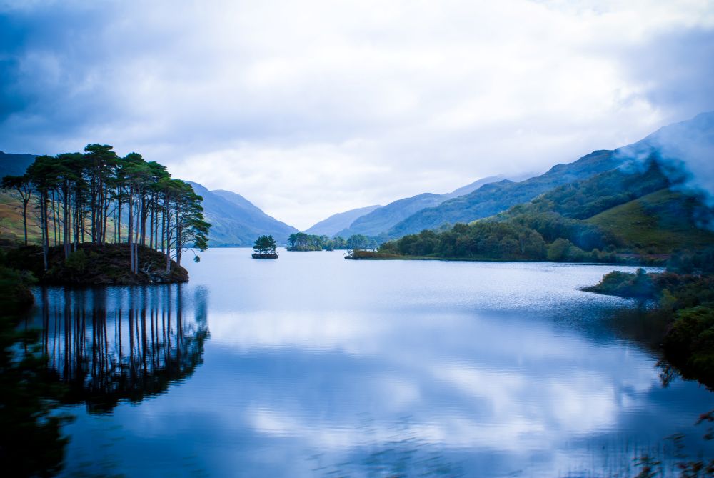
Loch Morar, Highland
Loch Ness may be more famous, but Loch Morar holds the depth record. Created by glacial activity around 10,000 years ago, Loch Morar reaches a depth of 310 metres, making it the deepest freshwater body in the British Isles. That’s deeper than The Shard is tall.
The loch even has its own legendary monster, Morag, although she remains far less famous than Nessie.
Britain’s largest lake
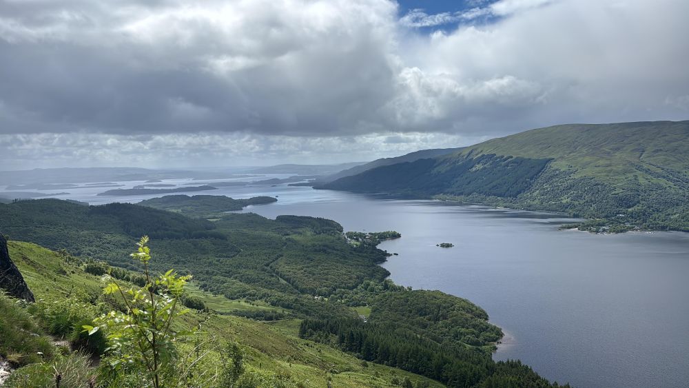
Loch Lomond
Loch Lomond covers approximately 71 square kilometres, making it the largest lake in Great Britain by surface area. Its combination of islands, mountains and accessible walking routes makes it one of Scotland’s most visited landscapes.
Trail magazine have shared a fabulous walk on our OS Maps App, taking you up to the summit of Ben Lomond which gives the most amazing views of Loch Lomond. It looks more like a sea.
Britain’s longest river
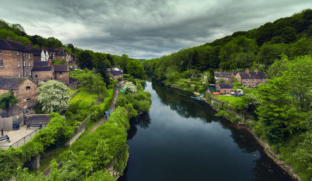
River Severn
354km
Rising from a small spring on the slopes of Plynlimon in Mid Wales, the River Severn travels around 354km before reaching the Bristol Channel, making it the longest river in Great Britain. Its journey takes it through some of Britain’s most varied landscapes, from the uplands of Wales to the floodplains of Shropshire and Worcestershire, before widening into the vast Severn Estuary.
The River Severn doesn’t just hold one record. After flowing over 350km from source to sea, it reaches an estuary with one of the world’s largest tidal ranges, regularly exceeding 12 metres.
Could you follow Britain’s longest river from source to sea?
For adventurous walkers, cyclists or paddlers, tracing the course of the River Severn offers a unique way to explore Britain’s longest river. Starting at its remote source on Plynlimon and finishing where fresh water meets the sea near Weston-super-Mare and the Severn Bridge, the route passes through market towns, historic bridges and some of the country’s most important wetland habitats.
Britain’s oldest rocks

Lewisian Gneiss, North West Scotland
Among the mountains and lochs of north west Scotland lies one of Britain’s oldest natural treasures. The Lewisian Gneiss formed almost three billion years ago, making it older than complex life and among the oldest exposed rocks in Europe.
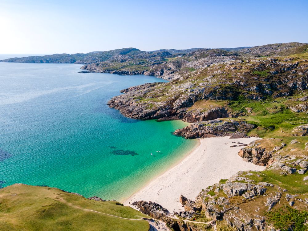
Standing on these ancient outcrops means coming face to face with a landscape whose origins stretch back to nearly half the age of the Earth itself, providing a glimpse into a world that existed billions of years before the first plants or animals appeared on land.
Why Britain’s extremes matter
On paper, these are simply records. The highest. The lowest. The wettest. The furthest.
In reality, Britain’s geographical extremes offer something much more valuable: a starting point for adventure.
You might set yourself the challenge of visiting all four mainland compass points, standing on Britain’s highest mountain, or tracking down the point furthest from the sea. Or perhaps you’ll create your own collection, seeking out Britain’s deepest lake, oldest rocks and highest waterfall.
The beauty of exploring Britain’s extremes is that there is no right way to do it. Some people are drawn to wild landscapes and geographical curiosities. Others prefer challenges shaped by human endeavour, from visiting Britain’s highest pub to finding the country’s lowest trig point. Every journey reveals a different side of Great Britain and encourages us to look more closely at the landscapes around us.
More than a century after my great grandfather John Naylor and his brother Robert became the first people to walk between the north eastern and south western extremities of Great Britain and document their journey, these remarkable places continue to inspire adventures of every kind. Some are world famous landmarks. Others are hidden corners that few people ever visit. Together, they reveal just how much variety can be found within a single island.
OS Maps is the perfect companion for the journey. Discover routes, plot your own adventures, save places you want to visit and explore every corner of Great Britain with the confidence that comes from trusted mapping. After all, half the fun of chasing Britain’s extremes is planning how you’ll get there.
More Extremes to Explore
One of the joys of exploring Britain’s extremes is that there is always another record to discover. Some are natural wonders hidden in remote landscapes. Others are quirky landmarks that make excellent additions to a walking, cycling or road trip challenge.
Whether you’re building a list of geographical records or simply looking for unusual places to visit, these extremes offer plenty more inspiration for future adventures.
| Extreme | Location | Why it’s worth seeking out |
|---|---|---|
| Highest sea cliff | Great Hangman, North Devon coast | The hill reaches an overall height of 318 metres (1,043 feet) with an impressive cliff face of roughly 244 to 250 metres (800 feet) |
| Highest pub | Tan Hill Inn, Yorkshire Dales | A legendary stop on the Pennine Way and Britain’s highest pub at 528m above sea level |
| Lowest trig pillar | Little Ouse, Cambridgeshire | One of the UK’s lowest trig points, proving not every OS landmark sits on a hilltop |
| Largest National Park | Cairngorms National Park | Home to five of the UK’s six highest mountains and Britain’s largest area of native woodland |
| Smallest National Park | The Broads | A unique network of rivers, fens and lakes created by medieval peat digging |
| Longest cave system | Ogof Ffynnon Ddu, Wales | More than 80km of mapped passages beneath the South Wales landscape |
| Highest village | Wanlockhead, Dumfries and Galloway | A former lead-mining settlement surrounded by rolling hills and moorland |
| Most remote mainland railway station | Corrour Station, Highland | No public road access, making it one of Britain’s most unusual stations |
| Longest place name | Llanfairpwllgwyngyll, Anglesey | Created partly as a Victorian publicity stunt and still a popular photo stop today |
| Highest road in Britain | Cairnwell Pass, Perth and Kinross | Climbs to around 670m on the A93 through the Cairngorms |
What extreme will you visit first?

County Tops – The Highest Points in every UK County
Discover the highest points in every UK county with our interactive map. How many County Tops have you conquered?

Let’s celebrate hills and mountains named after boobs!
Hills named after Boobs! A list of hills and mountains in the British Isles that are named after or shaped like breasts…
235 Years of Mapping Britain and Why We Barely Notice It
Discover how Ordnance Survey maps shaped Britain’s love of walking and cycling, and why 235 years of mapping now feels almost invisible.
By Hilary Pullen
Meet Hilary, Editor of OS Maps Discover. Hilary is based in North Wales and loves hiking with her dogs in the mountains of Eryri and Bryniau Clwyd, you can find her on Instagram @nearlyuphill and read her guides to walking in North Wales.
If you would like to be a featured OS Author and write an article or route guide find out more here – how to submit an article idea