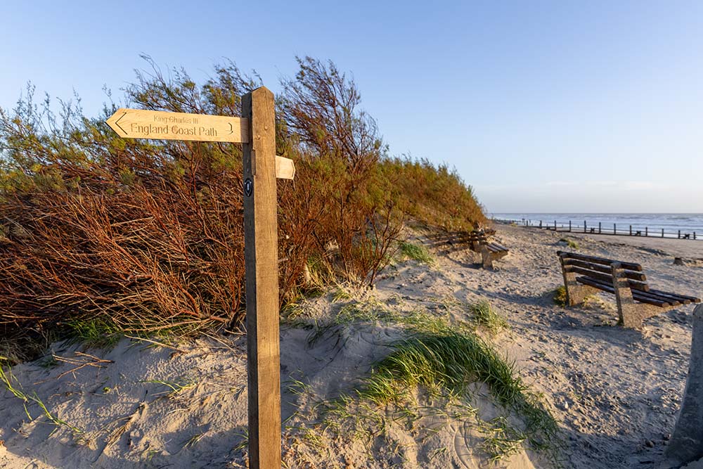
What is the King Charles III England Coast Path?
England has never had a single, continuous way to walk its entire coastline. Now it does.
The King Charles III England Coast Path is a 2,700 mile National Trail that follows the entire coast of England, connecting cliffs, beaches, estuaries and coastal towns into one continuous walking route.
It is the longest managed coastal walking route in the world and one of the most ambitious access projects ever delivered in the UK.
But more importantly, it changes how people can experience the coast.
Is the King Charles Coast Path Fully Waymarked?
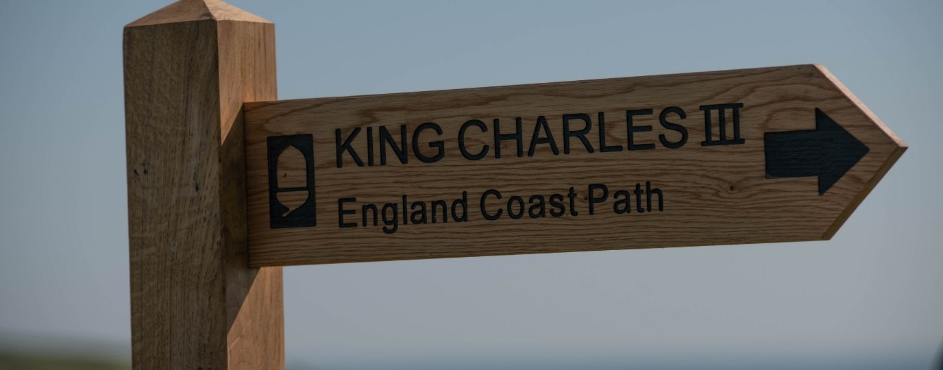
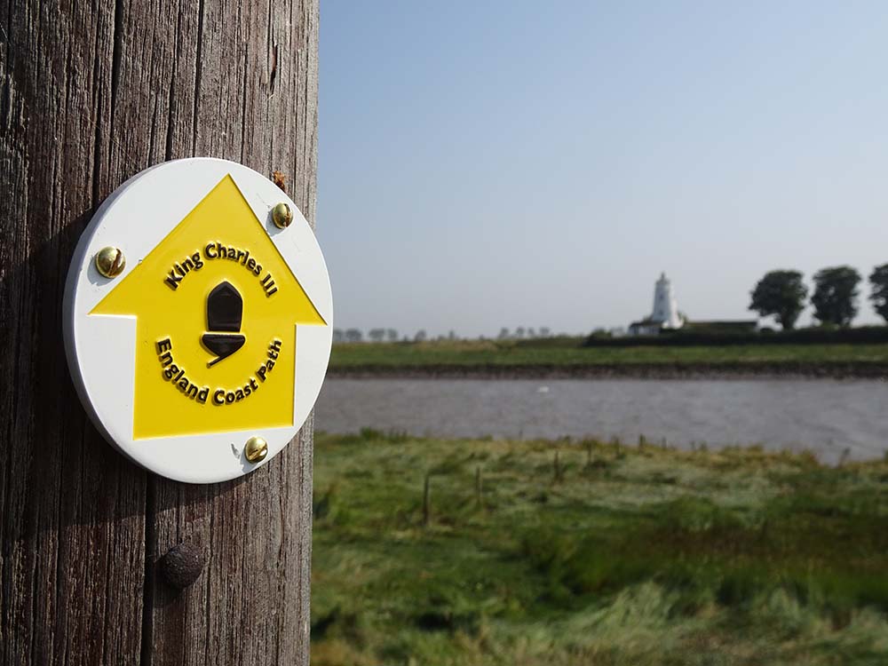
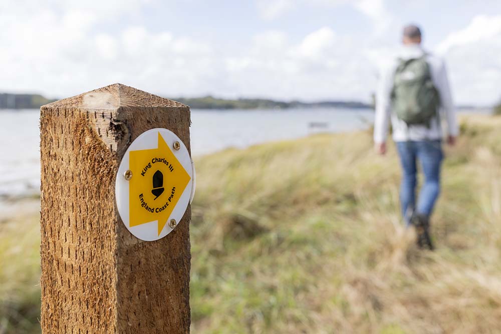
Yes! The King Charles III England Coast Path is a fully waymarked long distance walking route around England’s coastline.
- Total length: around 2,700 miles
- New path created: around 1,000 miles
- Existing paths improved: around 1,700 miles
- Standard: National Trail quality throughout
Who created the King Charles Coast Path?
It was created by Natural England, working with local authorities, landowners and outdoor organisations over more than 16 years.
The trail officially takes its new name in 2023 to celebrate the Coronation of King Charles III, and its full completion marks a major milestone in opening up the coast. You can now walk almost every part of the English coast, legally and accessibly, in one connected journey.
Why does the new English Coast Path matter for walkers? There’s already many coast paths?
For many people, coastal walking has always been fragmented. Routes often stopped abruptly. Access was unclear. The King Charles III England Coast Path changes that.
- Continuous access means you can follow the coast without gaps
- Improved infrastructure such as bridges, boardwalks and steps make routes easier to use
- Clear waymarking helps you stay on track
- Inclusive design ensures more people can enjoy the experience
It is not just about distance or completion. It is about confidence.
You do not need to plan a 2,700 mile journey. You can dip in anywhere and still feel part of something bigger.
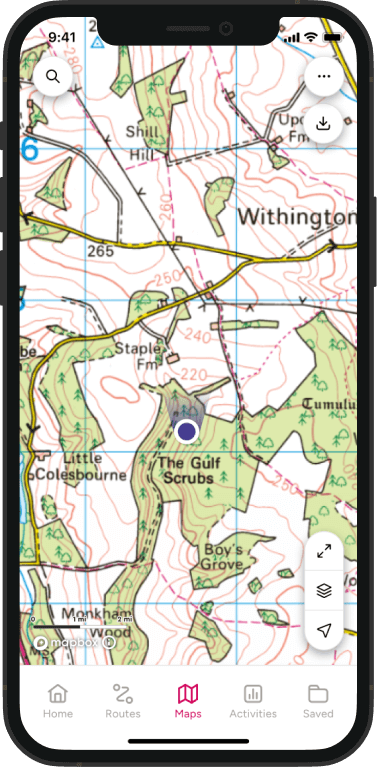
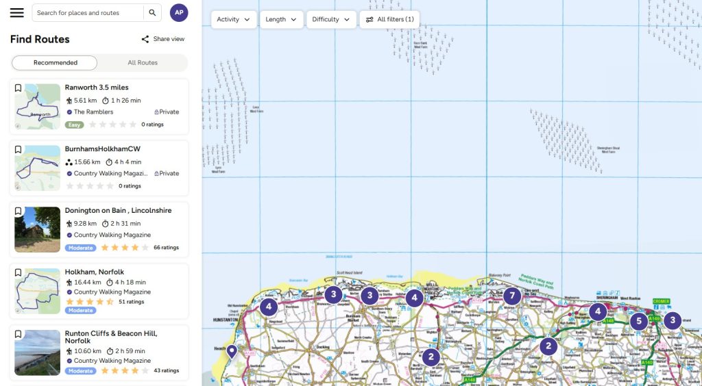
How to use OS Maps to explore the coast path
The full England Coast Path is made up of hundreds of shorter sections. Being able to see exactly where the trail runs, where access points and parking spots are and what terrain to expect makes a real difference.
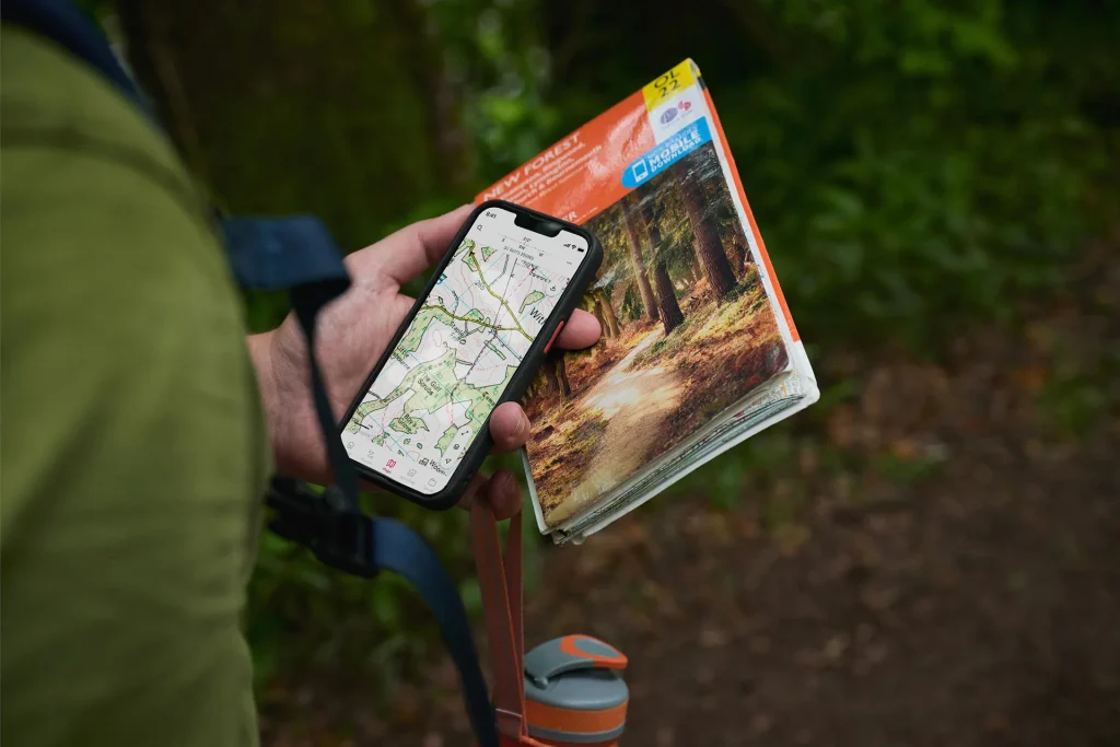
With OS Maps, you can:
- View the exact line of the coast path alongside detailed mapping
- Plan shorter circular or linear walks from the trail
- Check terrain, elevation and access points
- Download routes for offline use in remote coastal areas
Tip: Many coastal sections involve tidal areas, cliff paths or exposed terrain. Always check access, tide times and conditions before setting out.
What makes it different from other National Trails
The England Coast Path is not just another long distance path.
It introduces a new concept in access known as “coastal margin”. In many places, this gives you the right to access beaches, dunes and land next to the path. It is also designed to adapt over time with flexible rollback routing.
Flexible ‘rollback’ routing
As coastlines change through erosion, the path can move inland without losing access rights. This means the route is protected for the future.
10 of the best routes on the King Charles III England Coast Path
Below are ten standout sections to try. These will range from beginner-friendly coastal walks to more rugged stretches with big views.
1. Robin Hood’s Bay Circular Walk, North Yorkshire
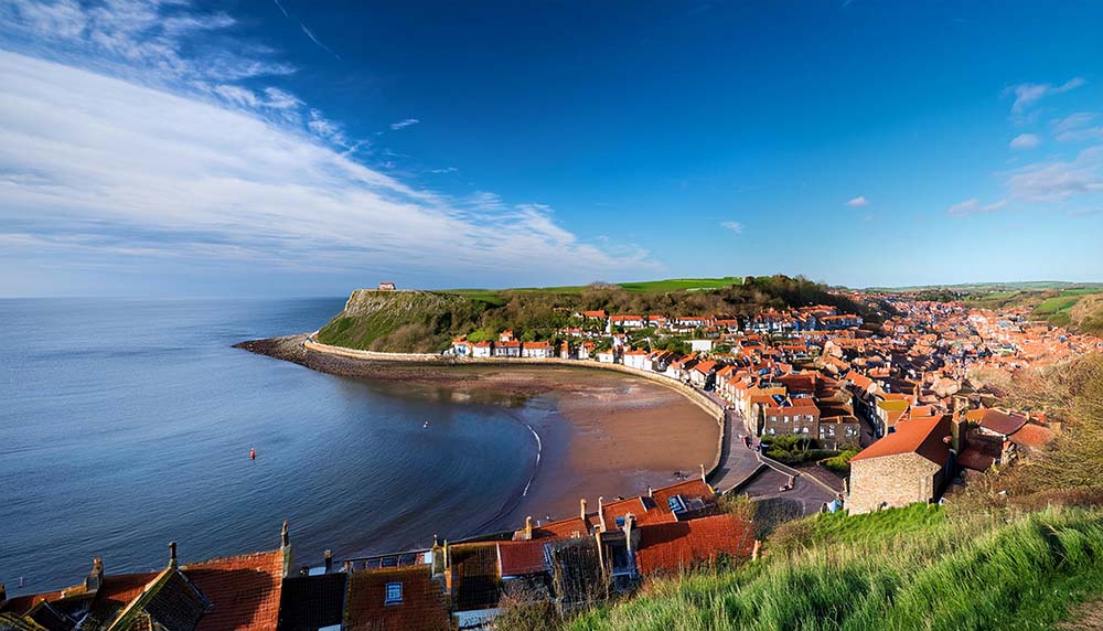
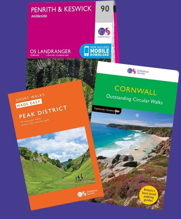
Clifftop walking with dramatic views and a clear, well defined path. This walk forms part of Ordnance Survey’s ‘Short Walks Made Easy‘ guide book series, which offer leisurely walks between 1 and 5 miles, with simple to follow step-by-step instructions
2. Lulworth Cove & Durdle Door Walk, Dorset
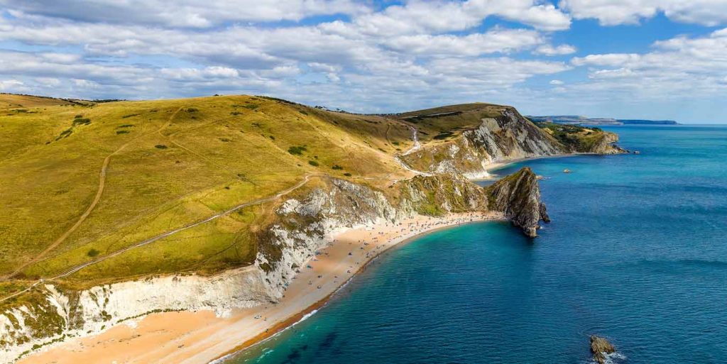
Emblematic of the Jurassic Coast World Heritage Site, Durdle Door formed as the sea gnawed through a weak point in the protruding limestone cliff, creating the arch we see today.
3. South Shields to Sunderland Walk, Tyneside
The 7.5-mile stretch from South Shields to Sunderland consists of a series of sandy bays and is packed with a rich variety of coastal wonders.
4. Hunstanton to Dersingham Walk, Norfolk
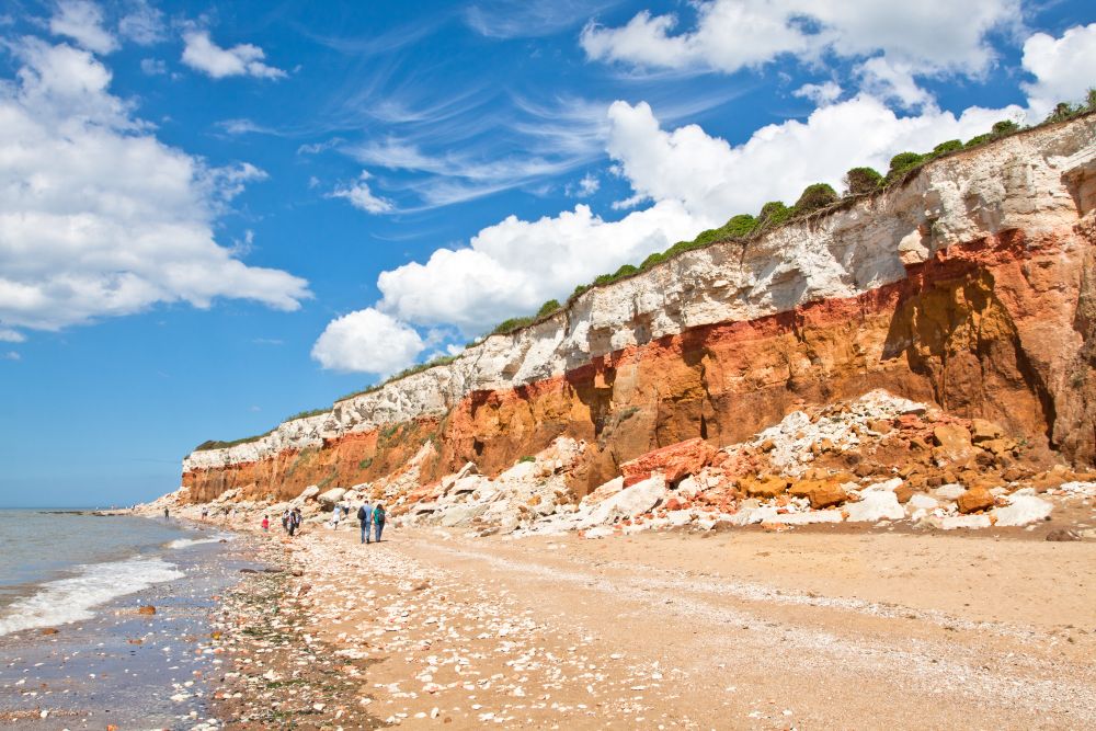
Grab your binoculars for this mostly-coastal ramble through the bird-rich countryside north of King’s Lynn.
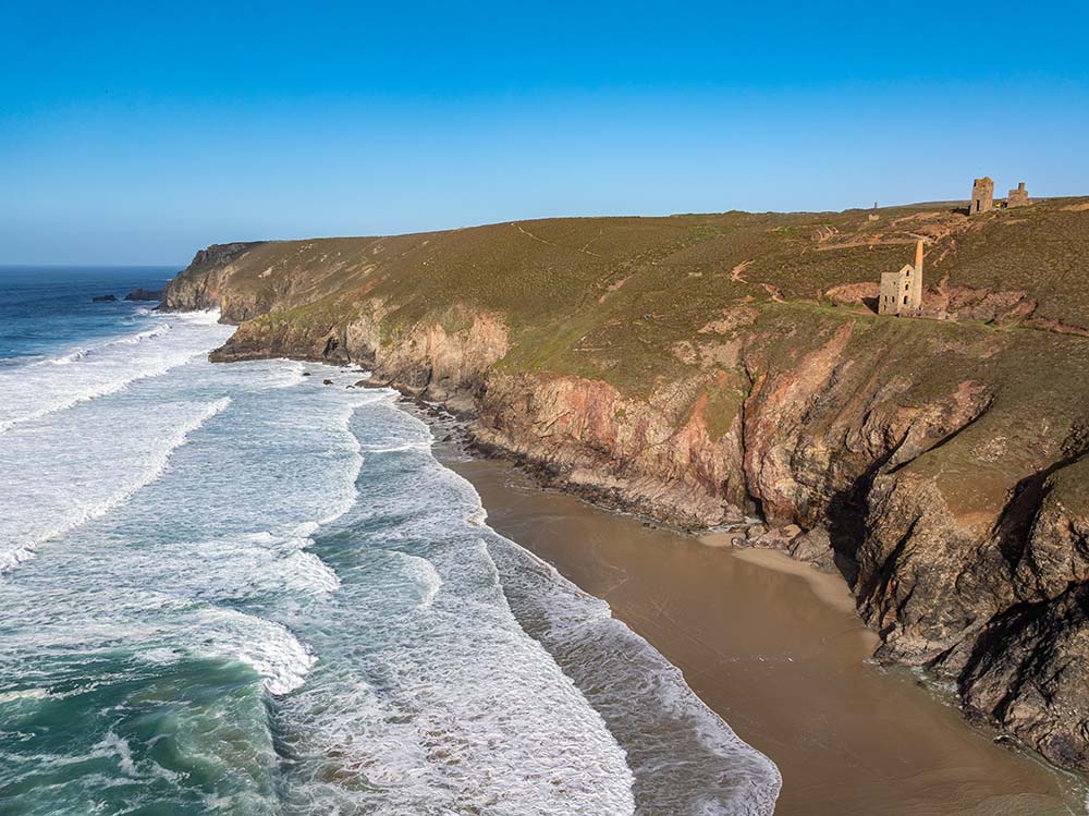
5. Church and coastguard Ways at St Ives, Cornwall
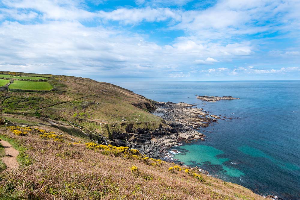
This is a very remote and wild part of the West Cornwall coast, a landscape of exquisite colours in spring and summer with steep, vegetated cliffs.
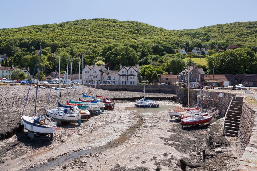
6. Bossington & Porlock, Somerset
This walk offers great views of Porlock Bay and the surrounding hills. En route are three very attractive villages, each with a selection of thatched, limewashed buildings.
7. Formby Point, Lancashire
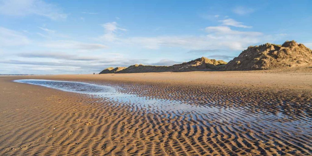
A beautiful walk along famous Formby beach and dunes.
8. White Cliffs of Dover, Kent
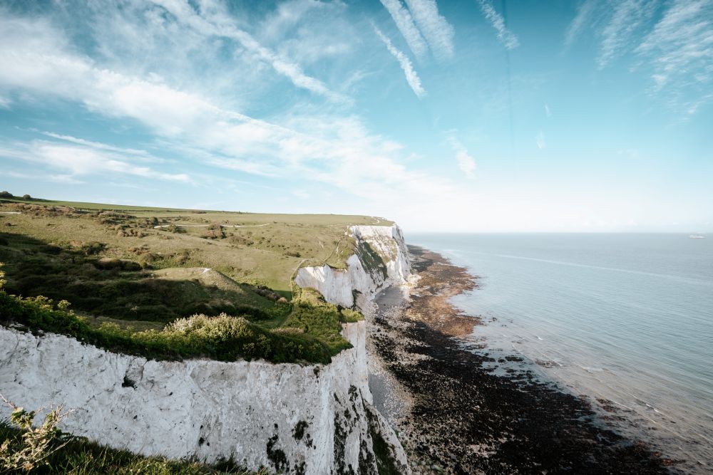
Dover’s famous white cliffs flank its busy port, providing exhilarating walking in either direction. On a clear day, the coastline of France can be seen.
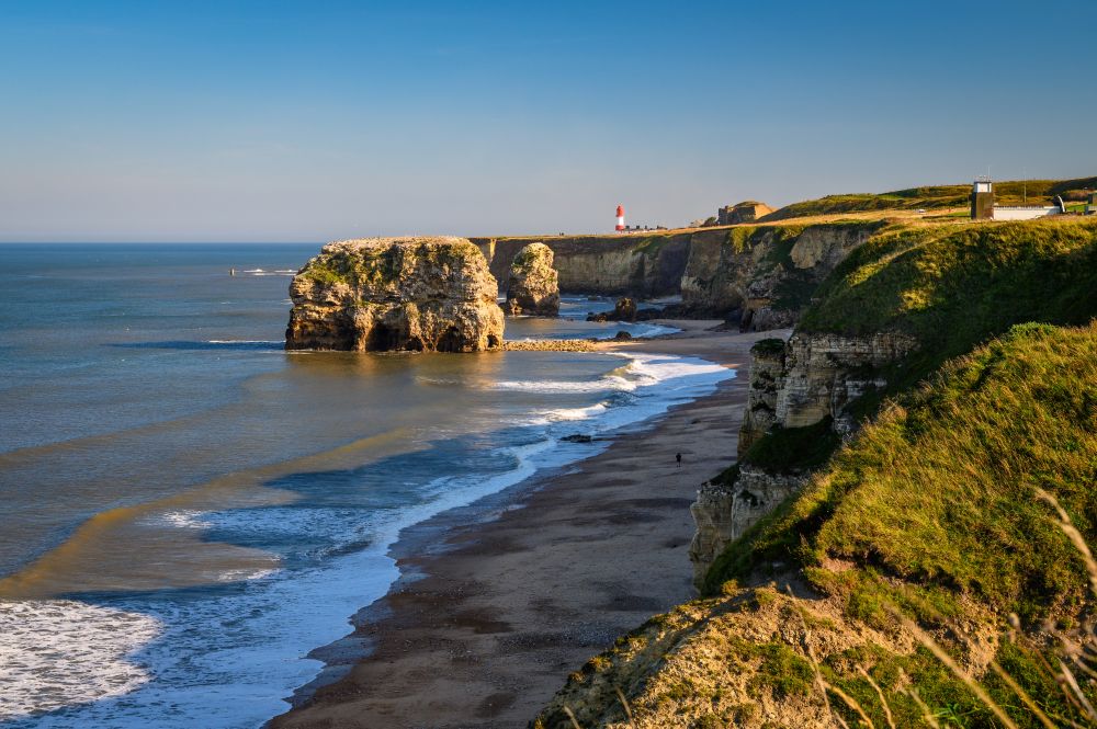
9. Flamborough Head, East Yorkshire
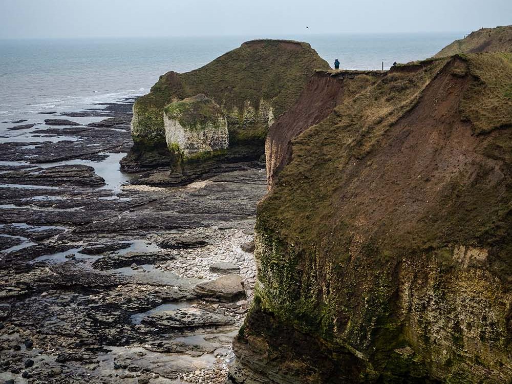
Flaunting the only chalk sea cliffs in northern England, Flamborough Head was designated a Heritage Coast back in 1979 for its outstanding scenery, geology and history, and its wealth of wild flowers, birds and marine life.
10. Amble, Northumberland

Sitting at the mouth of the River Coquet on the beautiful Northumberland coast, Amble is known as ‘The Friendly Port’.
Planning your walk on the England Coast Path
You do not need specialist gear or experience to get started. But a bit of planning will help you enjoy it more.
Choose the right section
- Look on OS Maps for 1000’s of recommended routes and add filters for circular routes and maximum distance
- If you’re creating your own route, start by looking for the car park symbol on spots along the coast

Check the terrain is suitable for everyone in your party
Coastal paths can include:
- Cliffs and steep ascents
- Sandy or uneven ground
- Tidal sections
Be aware of the weather
Conditions can change quickly on the coast, especially on exposed cliffs. Wind exposure is often the biggest factor to consider.
Navigation basics
Even on a well marked trail:
- Carry a map or use OS Maps App
- Know your start and end points
- Identify key landmarks along the route
By Hilary Pullen
Meet Hilary, Editor of OS Maps Discover. Hilary is based in North Wales and loves hiking with her dogs in the mountains of Eryri and Bryniau Clwyd, you can find her on Instagram @nearlyuphill and read her guides to walking in North Wales.
If you would like to be a featured OS Author and write an article or route guide find out more here – how to submit an article idea