Adventures from the doorstep: The 24 Hour Trigathlon
It was a typical wet December evening in the Scottish Highlands when our attention drifted to the OS Custom Landranger map hanging in our hallway.
“Where’s your nearest trig point?” asked my friend, Hamish.
This is not an unexpected question when your friends also love the outdoors. Trig pillars have a fascinating history and around 6000 of them remain across the UK. However, their simple appeal for many of us is that they often mark the achievement of reaching a summit. I pointed out the little blue triangle nestled in an area of woodland just a couple of miles away. I’d visited it a few months prior and returned with many scratches from the dense gorse.
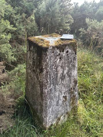
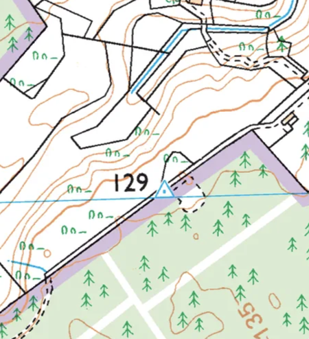
My local trig pillar, undervisited and underappreciated (Photo: James Nicholson)
My friend persisted. “And how many trigs are there on this map altogether? How long do you think it would take to visit them all?”
We had no idea. While some sat on obvious high summits, a closer inspection revealed trig pillars tucked away in more unexpected places. We spent the next few hours scouring the 40x40km map area, our enthusiasm building with every new blue triangle we spotted.
6 months later…
Fast forward to a sunny Saturday in mid June. I found myself perched on a makeshift stool looking out at 50 people squeezed into our modest back garden. There were families with young kids, a 78-year-old on an ebike and every generation in between. These were the competitors in the inaugural 24-hour Trigathlon.
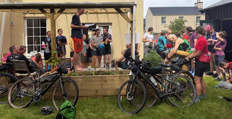
Trigathletes assemble before the event start at Saturday noon (Photo: Ross Campbell)
Things had somewhat snowballed since Hamish’s initial question. Repeated counts had upped our initial estimate of 30 trigs to a final total of 34. We proposed a 24hr challenge format (inspired in part by our house number). A few enthusiastic responses from close friends quickly morphed into a poster in the staff room at work and an online registration page. Soon, friends-of-friends and complete strangers started getting in touch to sign up. One friend had even created a poster on the history of trigpoints in our kitchen.
The challenge was simple:
“You have 24hrs to visit as many trig pillars as you can (or want to) on our local OS Custom map. You can use any human-powered travel …and you can also use public transport.”
The map area covered a diverse landscape, even for northern Scotland: from the high moors feeding the rivers Nairn and Findhorn, through plantation and native woodland to the flat coastal plains of the Moray coast and onto the rolling hills of the Black Isle. It encompassed the city of Inverness alongside the historic towns of Nairn, Forres, Fortrose and Grantown-on-Spey. Two railway lines and several inter-city bus routes added more route options. The highest trig point was on Carn Glas-choire at 659m and the lowest, Carse of Delnies, just 4 metres above sea level along a sandy coastal spit.
Bikes, boots and bus timetables
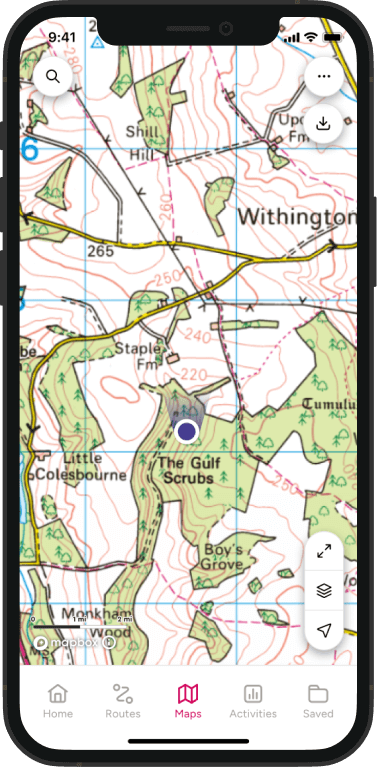
Most teams opted to use mountain or gravel bikes, though some undertook the challenge entirely on foot. Many ‘trigathletes’ spent weeks meticulously planning their routes using the OS Maps app alongside bus and train timetables. That said, I think it is hard to beat a paper map when planning long-distance routes. The fact that many competitors asked me to order them an event-specific OS Custom map suggested they agreed with me!
One of the highlights of the weekend was seeing people approach the challenge for different reasons. We had casual weekend cyclists, self-propelled Munro round record holder Jamie Aarons, a former Olympic silver medalist, several youth teams and even parents towing bike trailers. Getting the whole family to trig pillars sometimes involved secateurs or even carrying bike trailers to avoid waking sleepy toddlers. There was no shortage of excellent trig selfies (though this is a great guide if you need any tips).
Age was absolutely no barrier to pushing the limits, either. The youth category was won by 11-year-old Seb Islei, who tackled the challenge alongside his dad, Jan. Seb managed an incredible 13 trigs, including an off-map pillar in Culbin forest and even a quick wild swim.
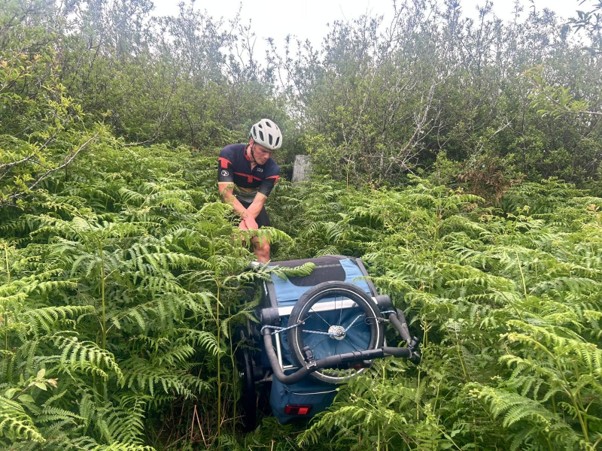
Accessing trig points can prove difficult with a bike trailer (Photo: Lizzie Richardson)
Fiona Stephen took part with her husband and 11-month-old daughter.
“Doing an adventure race with a baby takes a fair bit of advance planning, but naps and nappies weren’t going to stop us! We pedalled around 80km over two days in glorious Scottish sunshine, scooping up seven trigs. The trig by Inshoch Castle nearly defeated us with gorse, but we cannot wait to do it again next year, where we plan on swapping baby pedalling for toddler paddling.”
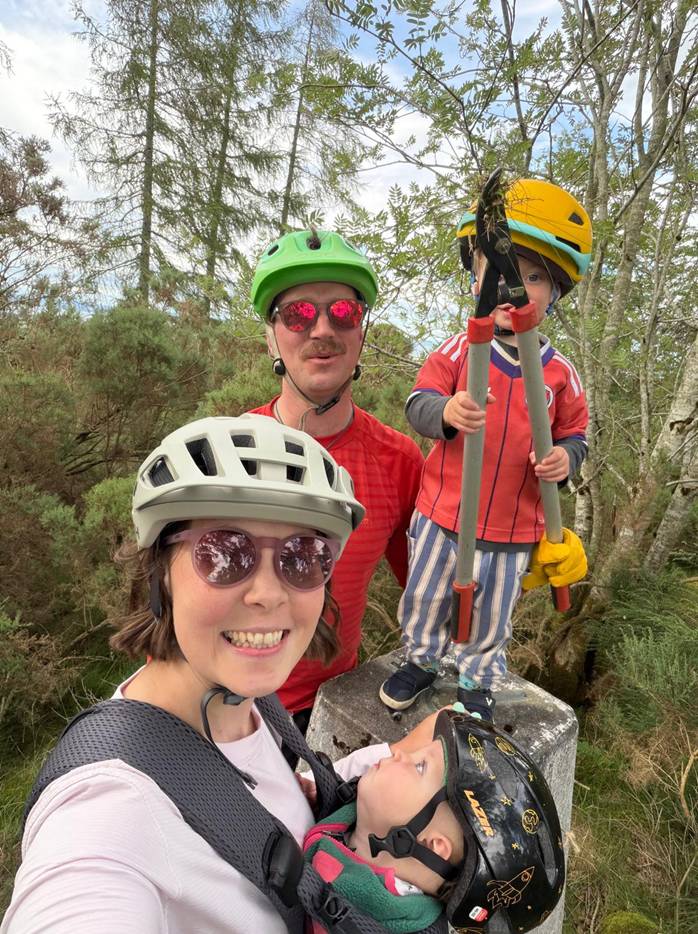
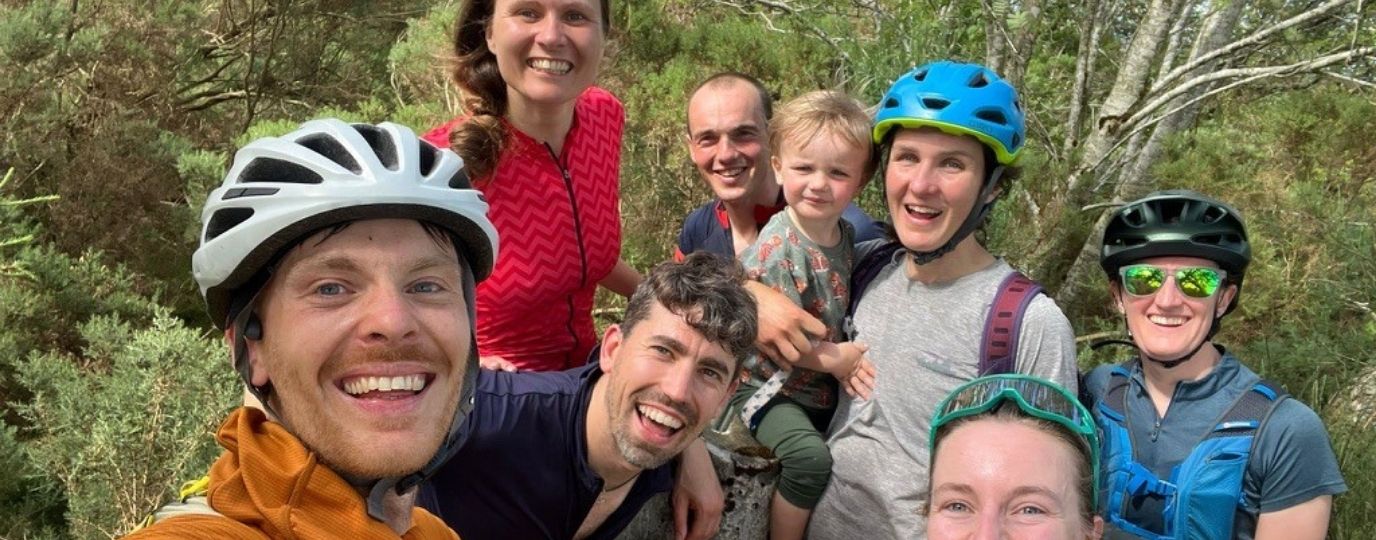
It takes a family to find a vegetated trig pillar (Photo: Heidi Volmer)
When night fell, many local competitors pitstopped at home. However, just as many opted to sleep outside on the moors. Seven people enjoyed a social camp at the highest trig, which proved surprisingly accessible thanks to the evening train from Inverness to Carrbridge. Their photos of the glowing midnight sky left us feeling quite envious at event HQ!
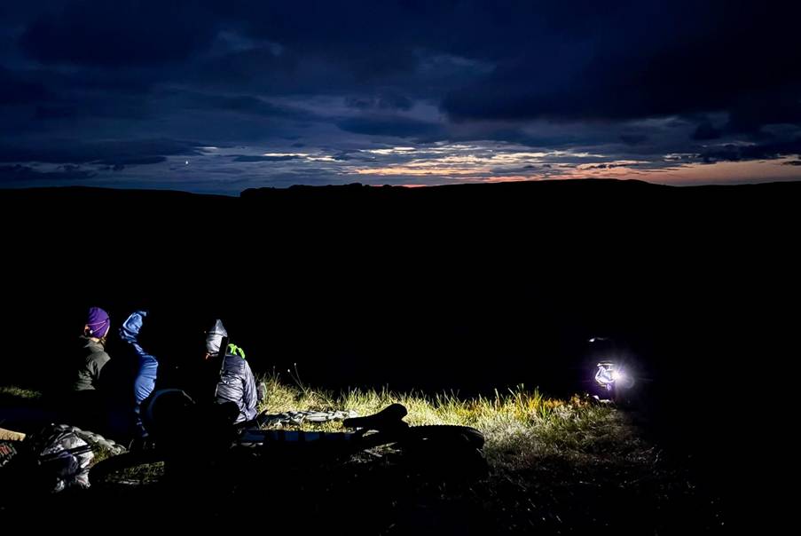
A social bivvy at the highest trig under the Highland ‘midnight sun’ (Photo: Dougal MacEwan)
At the sharp end of the event, several teams undertook impressive non-stop rounds. Team ‘Silly Ideas’ (Ross Chapman and Jamie Aarons) ticked 23 trigs in 24 hours.
“We loved that the event oozed inclusivity while affording us an opportunity to undertake a demanding personal challenge. Unlike adventure races or mountain marathons, in which you don’t know the checkpoints until the event starts, we enjoyed scrutinising the map in advance, drafting a strategy, and researching various sections. Some of the online descriptions (gorse bashing!) made us reevaluate plans several times. Not being local to the map area, this was also a cool way to visit parts of Scotland we’d never seen too. We were just buzzing about the concept!
We approached the event with the idea of pushing ourselves, including going through the night. At this time of year, it’s not dark for long, so the gifts of a sunset followed swiftly by a sunrise were appealing. There was a bike swap (from gravel to mountain bikes); hot food in thermoses; and a snack cache we’d hidden the night before the event.
My favourite trig was one at Mounthigh on the Black Isle. It was close to the road, but if you weren’t seriously looking for it, you’d never know it was there. It’s a piece of history becoming overgrown in modern times, but I love now knowing it’s there, trying to hold its own! Keep strong, little trig!”
The men’s solo category was won by Ryan Honeyman, who visited 22 trigs on the map plus 2 ‘off-grid’ trigs just beyond the map border. He was the only competitor to achieve 24 trigs in 24 hours – an astonishing effort over 295km with 3,465m of climbing. Sitting in event HQ, it felt pretty surreal watching Ryan’s small dot questing up onto the remote moors at 1:00AM, while most others were bedding down for the night.
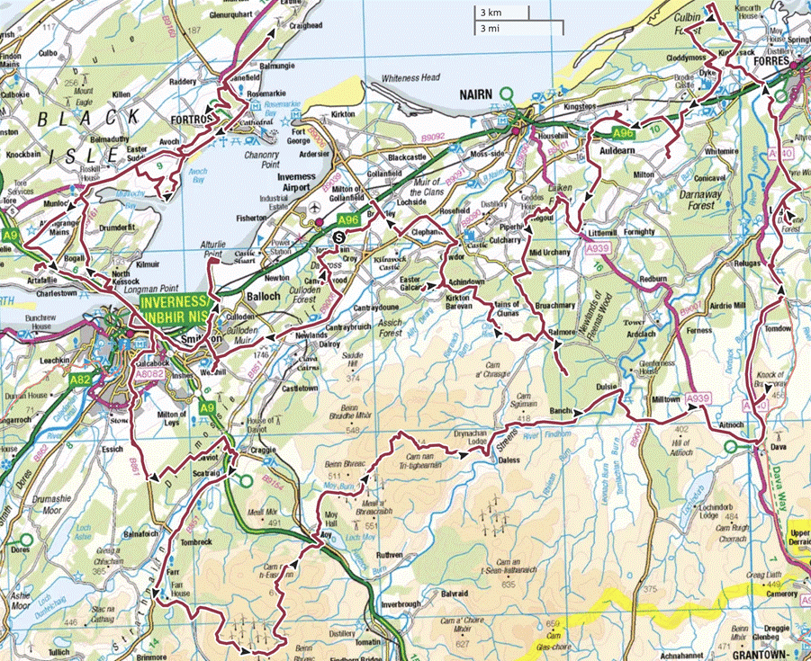
Ryan Honeyman’s winning route, bagging an incredible 24 trig pillars in 24 hours under human-power
Ryan confessed that a non-stop round was never his original plan.
“My planning process was basically just accidental enthusiasm. I initially wanted a casual ride and a bivvy, but once the map arrived, I spotted a moorland traverse that looked the right balance of ridiculous but doable. My mindset was just to keep going if I felt good and only stop if I absolutely had to. I just went for it and completely surprised myself! Apart from the tough moorland section and a few trigs hidden in the gorse, it was mostly brilliant gravel riding and the momentum carried me through.”
While the winning team and solo male competitors relied purely on pedal power, the first and third solo women made the savvy decision to leverage the rail network. By taking the train, they avoided a gruelling headwind. This was a great masterclass in how combining public transport with an OS map opens up endless local route opportunities.
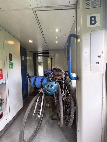
A quick hop upwind, all thanks to ScotRail (Photo: Freya Shepherd)
Trigathlon by numbers
Fifty trigathletes took part in the event (18 solo competitors, 10 pairs and 4 youth entries). Between them they visited 33 of the 34 trigs on the map. Three teams completed the challenge ‘analogue’ using no GPS and just the 1:50,000 map, which made their approaches to trigs a little tricky at times! Alongside prizes across the four categories, we also had awards for other feats including the best trig photo (you’ll find it at the bottom of this article…), most modalities of travel (5), best-swim spot and even visiting an ‘off-grid trig’ outside the map boundary. Another award was given to the trigathlete with the highest total sum of trig elevations (a remarkable 5838 metres). This prize proved effective in tempting people up onto the high moors and away from the relatively ‘easy’ coastal trigs. We had planned a prize for anyone visiting a unique trig (ie no other trigathletes also visited the pillar) but despite commendable attempts to visit very esoteric places, there were two visitors to both Meall Na Fuar Ghlaic (Beinn Dubh) and Cromwells Hill (Carn na Loinne), which were the least visited trig pillars.
Responsible access
We are fortunate to have the ‘right-to-roam’ in Scotland, which allows responsible access to most land for recreational use. The Scottish Outdoor Access Code is one of the things that makes me most proud to live in Scotland. Where we anticipated potential access issues, we consulted land managers ahead of the event. We were grateful to one local farmer who put up a temporary fence to partition a trig from a field of cows, and another offered water refills to weary cyclists passing his field margin. They probably thought we were mad, but they were respectful of our crazy idea nonetheless.
Of course, not all trigs wanted to be found. The most challenging trig pillar was undoubtedly ‘Lethen Bar’, buried deep within 8ft gorse on a former forestry plantation. An online report described this as “one of the most inaccessible trigs in Scotland” and TrigpointingUK suggested it may not have been visited for several years. However, it proved no match for 13 determined trigathletes armed with gardening gloves and secateurs.
A combination of OS maps, satellite imagery and online trip reports helped with route planning, explains Inverness local, Jack Wiseman. Occasionally, new estate and wind farm access tracks weren’t yet on the OS map, which provided some hidden surprises.
“I plotted different combinations of routes on the OS Maps app and went with the one with the least distance and elevation to achieve as many trigs as possible. I loved that everyone could approach the challenge in their own way. My favourite trig was the Knock of Braemoray at sunset, with big views in all directions. Just a few hours later came my worst: Beinn Mhòr at 2am in the drizzle, trudging through knee-high heather and tussocks. I later found out there was a landrover track up the other side of the hill!” writes Jack Wiseman, who came second in the Open Solo category.
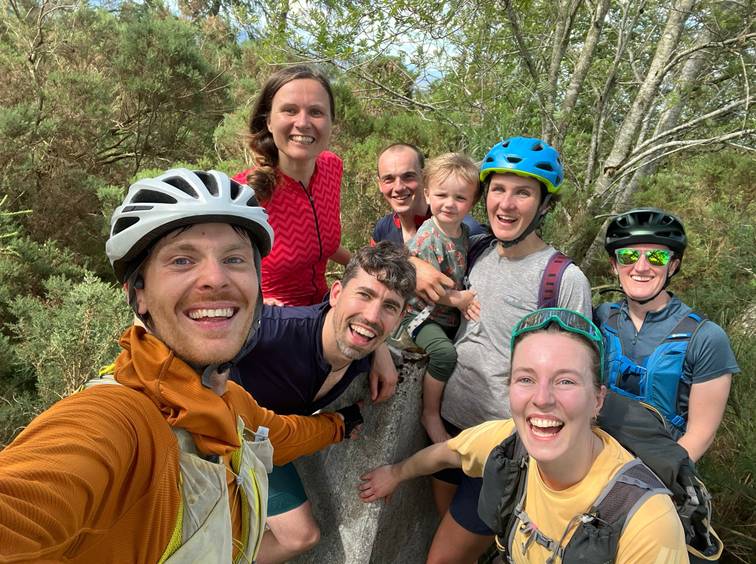
Trigathletes at Castle Findlay, another forgotten trig pillar in an area of felled forestry (Photo: Hamish Carter)
We finished the weekend with a large veggie chilli, cold drinks and a prizegiving. Huge thanks must go to the team at Ordnance Survey for supporting us with a selection of wonderful prizes from the OS Shop and also to Graham at TrigFigs, for handcrafting beautiful, miniature trig pillar trophies.
While the event wasn’t sponsored, we encouraged people to make a charity donation when they registered, which meant we were also able to donate £160 to our local Hospice after the event.
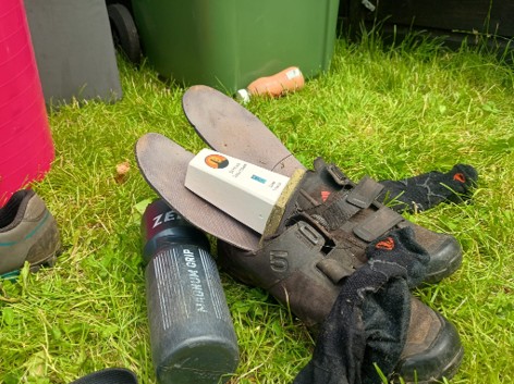
A safe place to store a trig pillar trophy (until next year?) (Photo: Jonathan Coney)
Looking closer to home
Lying sprawled on the grass in the afternoon sunshine, there was an opportunity to reflect on the weekend’s antics. Until this year, I certainly would not have called myself a trig enthusiast. I have always respected the select group of “baggers” who have ticked all 6,000 UK pillars. For me though, trigs are simply an excuse to get outside and explore (and often a reward for persevering to the top of a steep hill).
Living in Inverness, I am often guilty of spending my days off driving several hours to reach the high hills of Torridon, the Cairngorms, or the Fisherfields. But with these iconic landscapes nearby it is easy to overlook the places closer to home.
Over chilli, everyone agreed they had discovered a new network of trails and hidden places right on our doorstep. Sure, some of these lonely concrete pillars are unvisited for good reason, but many others are well worth a return trip. Even the most experienced local cyclists admitted they’d found tracks that they never knew existed. Remarkably, no two teams took the same route and between us we visited all but one trig on the map. Once the dust had settled, I made a point of cycling there for a camp the following day.
My first foray into event organising turned out to be a mix of massive spreadsheets, anxious ‘dot-watching’, sleepless nights wondering if anyone would kayak across the Moray Firth (thankfully, they did not) and peeling 5kg of onions at 1am. But watching our silly idea develop into fifty distinct 24-hour adventures was a real privilege. If you’ve ever been tempted to start a grass-roots event in your local area, I can’t recommend it enough.
So…where is your nearest trig pillar? And how many trigs have you visited on your local OS map?
Whether it is a 24-hour challenge or a year-long project, trig bagging is a great way to explore your local area and develop connections to the places where we live. It’s an idea echoed beautifully in Alastair Humphreys’ book Local (a highly recommended read for backyard adventuring).
The Trigathlon will, of course, be back next year. We’ll be moving to a different Landranger map, so it won’t be on my doorstep next time – but it will be on someone else’s. After all, it’s just the excuse we need to go hunting for more concrete pillars hiding in the local places we often overlook.
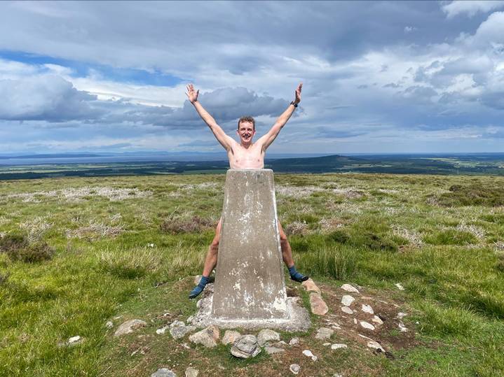
Waterproof socks: a vital addition for accessing moorland trigs (Photo: Emma Parry-Jones)
Follow @trigathlon for more 24hour trig bagging adventures.
Easy Thoughtful Gifts You Can Post for Christmas or Birthdays
One of the most affordable, thoughtful and easy gifts you can post – From just £7.99 for our small personalised maps, UK postage is free.
UK 24 Hour Mountain Challenges – Distances & Ascents
A list of the UK’s most iconic 24hr hiking challenges – how many have you conquered?
15 Microadventures You Can Try This Weekend Without Taking Time Off
We share 15 ideas for your next microadventure – a microadventure is a mini escape into nature without the need to take time off work and spend a fortune!