
How long will this walk take?
Every year, walkers are caught out by one simple planning mistake: assuming a route will take less time than it actually does. Knowing how long a walk will take is one of the most important parts of route planning. It helps you choose routes that match your experience, plan breaks and make the most of the daylight available.
This is especially true in autumn and winter, when shorter daylight hours leave less room for error. Understanding how to estimate route times can help you plan more confidently and avoid finishing a walk after dark.
For more than 130 years, walkers have used Naismith’s Rule as a quick way to calculate journey times. Modern route planning tools, including OS Maps, build on these principles using Scarf’s method and personalised activity speeds to provide route time estimates tailored to the route you’re planning.
Naismith’s Rule – Quick Explanation
If you want a quick estimate of how long a walk might take, Naismith’s Rule is one of the simplest and most widely used methods available.
Allow 1 hour for every 5km walked, plus 1 hour for every 600m of ascent.
For example:
- 10km walk with 0m ascent = around 2 hours
- 10km walk with 600m ascent = around 3 hours
- 15km walk with 900m ascent = around 4 hours
It is not designed to predict your exact finishing time. Instead, it provides a useful starting point for route planning and helps you judge whether a route is realistic for the time available.
From Naismith to Scarf: How Walking Time Estimates Have Evolved
For more than a century, walkers have used William Naismith’s famous rule to estimate journey times in the hills.
As route planning moved from paper maps to digital tools, researchers began exploring whether the relationship between distance and climbing effort could be measured more precisely. One of those researchers was Philip Scarf of the University of Salford, whose work examined the “equivalence of distance and climb” in mountain navigation. Research suggested that 1 metre of ascent could be treated as roughly equivalent to 8 metres of horizontal travel, creating a practical way of comparing routes with different amounts of climbing.
This concept forms the basis of Scarf’s method, which OS Maps uses to calculate estimated route times.
How to calculate walking time using Naismith’s Rule
Follow these three steps.
1. Measure the route distance
Start by finding the total distance of your planned walk.
If you’re unsure how to do this, see our guide:
Internal link: How to Measure Distance on a Map
2. Find the total ascent
Total ascent is the cumulative amount of climbing across a route.
For example:
- Walking up one 300m hill = 300m ascent
- Walking up three separate 300m hills = 900m ascent
This is one of the most important factors affecting how long a walk will take.
3. Apply the formula
Let’s imagine a route is:
- 12km long
- 800m total ascent
Distance:
- 12km ÷ 5km per hour = 2 hours 24 minutes
Ascent:
- 800m ÷ 600m per hour = 1 hour 20 minutes
Estimated walking time:
3 hours 44 minutes
That’s your baseline estimate before allowing for breaks, photography, wildlife watching or lunch stops.
Why ascent matters more than you think
Many people focus on distance alone when planning a walk.
A flat 10km walk around a country park feels very different from a 10km mountain route with 1,000m of climbing.
This is why two walks with identical distances can take dramatically different amounts of time.
For example:
| Route | Distance | Ascent | Estimated Time |
|---|---|---|---|
| Flat canal walk | 10km | 50m | Around 2 hours |
| Mountain walk | 10km | 1,000m | Around 3 hours 40 mins |
The climbing often has a greater influence on duration than the distance itself.
How accurate is Naismith’s Rule?
It’s usually accurate enough for planning, but it’s never going to be spot on.
Naismith’s Rule assumes:
- A reasonably fit walker
- Good weather
- Clear paths
- Simple navigation
- Normal outdoor conditions
It does not account for:
- Deep mud
- Peat bogs
- Rocky terrain
- River crossings
- Navigation challenges
- Strong winds
- Snow and ice
- Heavy backpacks
- Group dynamics
- Rest stops and lunch breaks
In other words, it works best as a planning tool rather than a prediction. It provides a useful benchmark, but real world conditions will always affect your pace.
From Naismith to Scarf: How Walking Time Estimates Have Evolved
For more than a century, walkers have used William Naismith’s famous rule to estimate how long a route will take. Its simplicity is one of the reasons it remains widely used today.
As route planning moved from paper maps to digital tools, researchers began exploring whether the relationship between distance and climbing effort could be measured more precisely. One of those researchers was Philip Scarf of the University of Salford, whose work examined the “equivalence of distance and climb” in mountain navigation.
Scarf’s research found that, for route planning purposes, 1 metre of ascent can be treated as equivalent to around 8 metres of horizontal travel. In other words, climbing 100m requires a similar effort and time investment to walking approximately 800m on level ground.
This concept forms the basis of Scarf’s method, which is used by OS Maps to calculate estimated route times.
How OS Maps calculates route time
Rather than applying a fixed time allowance for ascent, OS Maps converts climbing into an equivalent distance.
Equivalent distance = route distance + (total ascent × 8)
The estimated route time is then calculated using your selected activity speed.
Example
Imagine a route is:
- 10km long
- 500m of total ascent
The ascent is converted into an equivalent distance:
- 500m × 8 = 4km
This is then added to the route distance:
- 10km + 4km = 14km equivalent distance
If your activity speed is set to 5km/h:
- 14km ÷ 5km/h = 2.8 hours
Estimated route time: approximately 2 hours 48 minutes.
Traditional timing rules assume everyone walks at roughly the same pace.
In reality:
- A fast hillwalker may comfortably exceed 5km/h.
- A family group may move more slowly.
- Trail runners can travel significantly faster.
- Terrain and conditions can dramatically affect speed.
By combining equivalent distance with your chosen activity speed, OS Maps can provide route estimates that are more personal and flexible than a one-size-fits-all formula.
Customise your activity speed in OS Maps
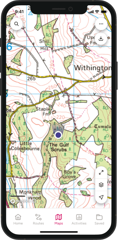
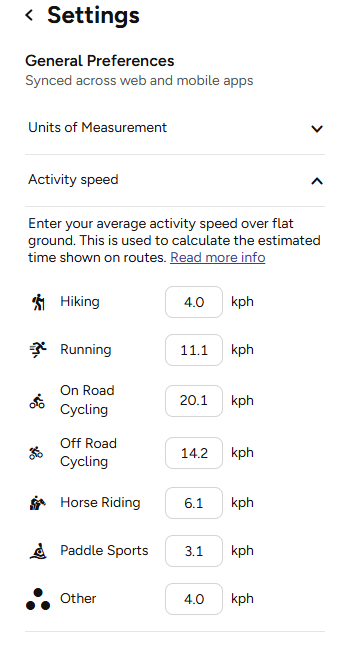
OS Maps allows you to customise activity speeds so estimates better reflect how you travel outdoors. You can also switch between miles and kilometres if preferred.
Settings → Change activity speed → Save
The default walking speed is set to 4km/h.
Test route time estimates against your own walks
Whether you’re using Naismith’s Rule, Scarf’s method or the estimated times shown in OS Maps, the best approach is to compare estimates against your real walking times.
For your next few routes:
- Record the route distance.
- Record the total ascent.
- Note the estimated route time.
- Compare it with your actual moving time.
After a handful of walks you’ll develop a much clearer understanding of your own pace, making future route planning more accurate and more confident.
What about downhill sections?
One of the most common criticisms of traditional walking time formulas is that they focus heavily on ascent and relatively little on descent.
Walking downhill can sometimes be faster than walking on level ground. However, steep descents often slow progress because of loose rock, rough terrain, wet conditions or the need to protect tired knees.
This led later outdoor experts, including Eric Langmuir, to develop refinements that account for different downhill gradients.
In practice, however, no formula can fully account for every route. A gentle grassy descent in the South Downs feels very different from a rocky descent in Eryri (Snowdonia) or the Lake District.
That’s why route time estimates should always be treated as a guide rather than a guarantee.
Head out with greater confidence
Naismith’s Rule remains one of the most useful route-planning concepts ever developed. More than 130 years after it was first proposed, it is still an effective way to understand how distance and ascent influence journey times.
Modern tools such as OS Maps build on those foundations using Scarf’s method and personalised activity speeds to provide route estimates that better reflect both the route and with added personalisation it’s even more accurate.
Whichever approach you use, the goal is the same: to plan realistic routes, manage your time outdoors and head out with greater confidence. The more you walk, the better you’ll understand your own pace and the more useful route time estimates become.
By Hilary Pullen
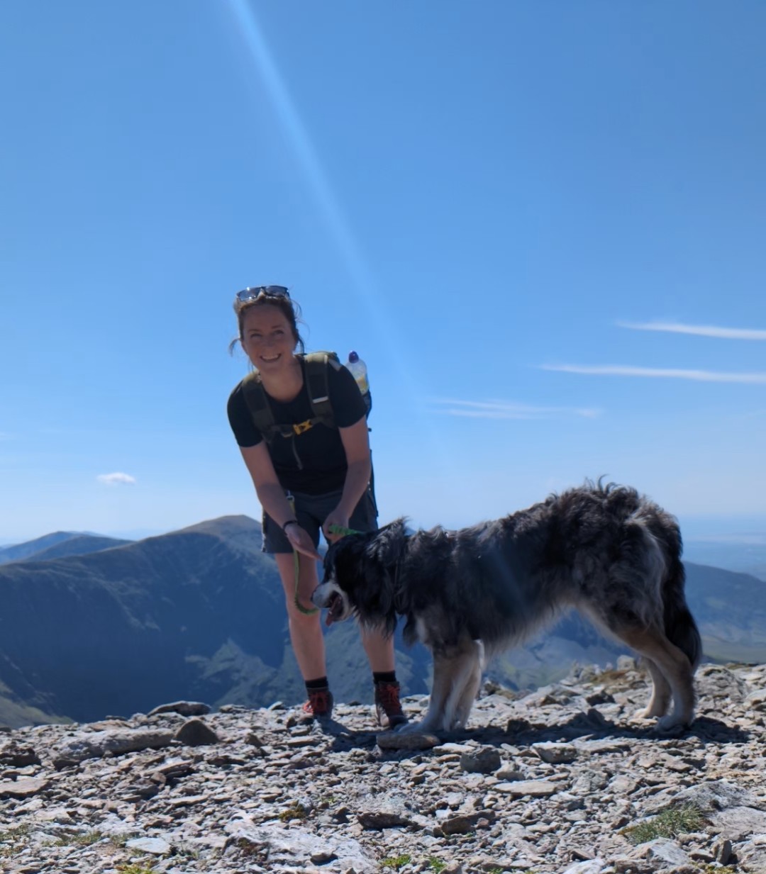
Meet Hilary, Editor of OS Maps Discover. Hilary is based in North Wales and loves hiking with her dogs in the mountains of Eryri and Bryniau Clwyd, you can find her on Instagram @nearlyuphill and read her guides to walking in North Wales.
If you would like to be a featured OS Author and write an article or route guide find out more here – how to submit an article idea