Why tides matter – staying safe on coastal routes
A recent BBC News article highlighted the RNLI rescue of a woman who had been cut off by a rising tide. Since many walks in coastal areas (or just a wander on a beach) can be affected by tides, here’s a FAQ on tides for walkers and hikers.
Tide Times FAQs
No! They vary considerably from place to place, affected by the shape of the land. Some places have a much larger tidal range (the maximum height difference between low water and high water) than others. You also get unusual local conditions, like a double high tide or a tidal bore.
It takes around 6.25 hours on average to go from high tide to low tide or vice versa, but it can vary quite a bit by location. This means high tide to the next high tide is typically about 12.5 hours.
Tide times are influenced by the moon, so do not follow a 24 hour cycle. The high tide will be a different time each day, usually around 50 minutes later than the previous day.
No! Tides also affect estuaries and tidal rivers, salt marshes and causeways.
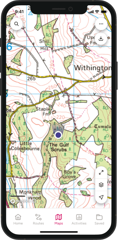
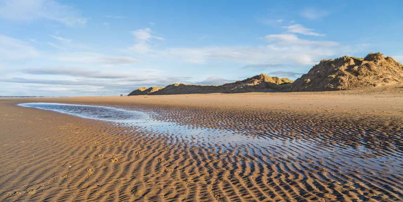
While you will occasionally see “NTL” (Normal Tidal Limit) on an OS Map, most of the time you have to use terrain clues to spot tidal areas. Yellow areas are sand, while brown is mud. If these are next to the sea or a river and there are few or no contour lines – indicating they are flat – they are almost always tidal.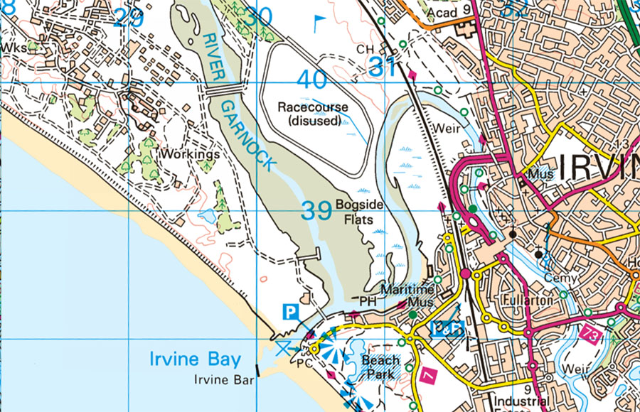
The key risk to walker is a rising tide cutting off routes. This can leave you stuck in the wrong place, or worse, leave you stuck in an area that itself is going to be underwater.
On a beach, tides can push you to walk underneath cliffs. This poses a risk from falling rocks as well as being trapped as the tide continues to rise. A rising tide can also soften boggy ground or firm sand into something much softer, and near impossible to cross.
Tides change fastest midway between high and low (or the other way around), which is when you will see the strongest currents and most rapid height changes.
In some places an incoming tide can move faster than walking pace.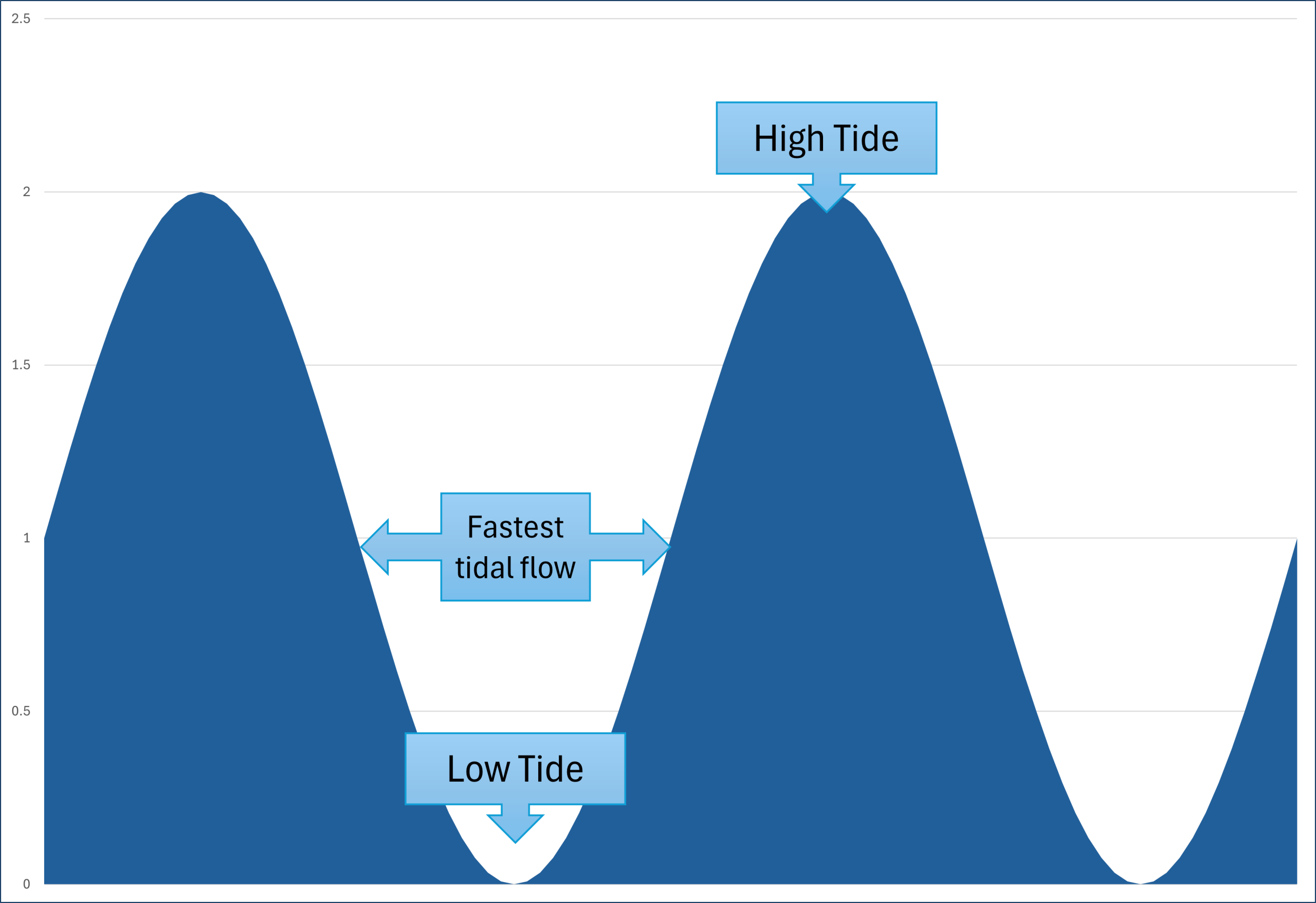
The biggest risk for anyone in or on the water is that the tidal flow can be faster than you can swim or paddle, meaning you are going with the tide whether you want to or not. Even for slower tidal currents, it may take a lot more time and energy getting back than expected.
Tidal water can be deceptive as the water may look calm; it’s only when you check a fixed point on shore the movement becomes apparent. Rivers can be tidal a significant distance from the sea, and out at sea longshore drift can push you a long way from where you launched.
Anyone in the water needs to careful around piers and groynes as the tide is a peak flow as strong currents can push you into them – keep well clear.
The ‘official’ tide times are maintained by the UK Hydrographic Office. They show tide times for the next seven days at over 700 ports in the UK and ROI. See easytide.admiralty.co.uk
It’s very important that you choose the location closest to where you will be walking, as tide times can vary significantly from place to place.
TideTimes website shows a more user friendly site (with less technical detail) based on the official data. They also sell printed tide tables. See TideTimes.org.uk
On Apple or Android devices, check Tidepoint App for a convenient tide check for frequent users.
You will also find printed tide table booklets available in bookshops and beach shops in many coastal towns. Local hotels and B&Bs will often have one displayed too.
1. Check you have the correct named location
2. Check if the times are in BST (British Summer Time) or GMT (Greenwich Mean Time). You might need to adjust!
3. Look down the list for the relevant date
4. On that row, the table will show a time for each low tide (L or LW) and high tide (H or HW) typically using the 24 hour clock. It may also show the tide height in metres above low tide.
Spring tides are the biggest tides of the month. Higher than normal high tides, and lower than normal low tides, giving the largest tidal range (difference between high and low water). This also creates the strongest tidal flows and currents.
Sometimes a spring low tide may be lower than normal low water, giving a negative height figure in the tide table. It also might expose land you don’t normally see.
Spring tides happen roughly twice a month, around the new moon and around the full moon, when
the sun and moon line up and the combined gravity makes the tides stronger. They do NOT only happen in spring, but are all year round
Neap tides are the opposite; the smallest tides of the month. They have lower high tides and higher low tides, with a smaller tidal range and slower tidal currents.
You see neap tides in the first and third quarter moons, twice a month as the suns gravity and the moons gravity partially cancel each other out.
Super tides (officially Perigean Spring Tides) are spring tides that are especially strong due to a combination of factors such as the Earth’s distance from the sun, often combined with weather effects like strong onshore winds.
This can create a high tide substantially higher than normal (50cm or more!) placing even normally safe paths at risk of flooding. They also tend to be associated with large waves, which can be dangerous on sea walls, piers and jettys.

Here’s your quick tide safety checklist:
- Check tide times and heights. Be especially cautious if there are warning of super tides.
- Plan to be off tidal ground well before high tide
- Do not enter tidal water above ankle depth due to potential strong currents
- Tell someone your route
- Carry a phone (and know any signal blackspots)
- Turn back early if unsure
Fun tidal facts
The Bristol Channel and Severn Estuary near Avonmouth has one of the largest tidal ranges in the world with maximums over 15 meters in the strongest spring tides. That’s over three double decker busses, stacked on top of each other!
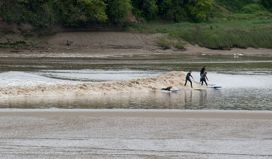
The Severn also has the UKs strongest tidal bore – a wave pushed upriver by the tide. I reaches up to 2m high and can travel 40km upstream past Gloucester. Tidal bore surfing is a popular challenge.
While people have always been aware of tides, extensive “Tidal Ledgers” covering 168 sites were created by the British Admiralty starting in 1834. They were modernised into the current UK National Tide Gauge Network after the 1953 storms and use automated reporting systems.
According to the NOAA, due to complex gravitational interactions tidal patterns only completely repeat every 18.6 years.
Since the high tide “bulge” follows the moon, it races around the world at around 450 miles per hour.
In theory the gravity from the sun and moon affect everything, so even your mug of tea has tides. They are just really, really small.
Your route back to reality

The Official Ordnance Survey App