I Think I’m Lost: What to Do if You Lose Your Way While Walking
Realising you’re not quite where you thought you were can be unsettling, but it doesn’t automatically mean you’re in danger. Getting temporarily lost is more common than many walkers realise. In fact, when we spoke to Mountain Leaders, navigation tutors and outdoor instructors through the National Navigation Award Scheme (NNAS), many shared stories of times when they themselves had become disorientated or made navigation mistakes.
This guide explains some simple steps to help you stay calm, assess the situation and get back on track safely. Remember asking for help from Mountain Rescue is not embarrassing and it’s better to call early before a situation escalates.
How to Call Mountain Rescue
Call 999 and ask for the Police, then ask them for Mountain Rescue
What should I do if I think I’m lost?
If you’ve searched for “I think I’m lost” while out walking, the most important thing to do is stop, stay calm and assess the situation before making your next move.
- Stop walking and assess the situation.
- Stay calm and avoid rushing decisions.
- Check your phone battery and signal, if you have a phone.
- Look for recognisable features around you, such as paths, walls, streams, roads or buildings.
- Try to work out when and where you last knew your location.
- Consider whether safely retracing your steps is an option.
- Use any navigation tools you have available, such as a map, compass, GPS or navigation app.
- Check the weather, visibility and remaining daylight.
- Call Mountain Rescue early if you’re concerned for your safety.
Before worrying about map skills or navigation techniques, focus on the basics.
Stop walking
Continuing to walk while unsure of your location usually makes the problem harder to solve. Stop somewhere safe and take a few moments to think before making your next decision.
Stay calm
Feeling anxious is normal, pause for a few deep breaths and gather your thoughts. Many experienced walkers have found themselves uncertain of their location at some point. Panicking often leads to rushed decisions, while taking a few minutes to think clearly can help you work out where you’ve gone wrong.
The best advice I wish I had been given earlier would be to take my time, not rush any decisions and to follow a methodical approach to any situation I find myself in. Steven Sunners, Hill and Moorland Leader and NNAS Tutor
Check your phone battery and signal
Even if you don’t use your phone for navigation, it may be your most important communication tool.
- Turn on battery saver mode.
- Close unnecessary apps.
- Turn off Bluetooth
- Consider using airplane mode if you have no signal but may need power later.
If you only have a few bars left and you’re lost, text or call 999 to ensure they can locate you and send help before you have no means of communication left.
Set up emergency texts in advance!
The 999 messaging service uses GPS to send through a distress signal to the emergency services, perfect for when you’re out hiking with no signal. To enroll all you do is text “Register” to 999 and follow the instructions they text to you.
Look around carefully
Ask yourself:
- What can I actually see – do I recognise anything at all?
- Am I on a path?
- Can I see a wall, stream, fence, forest edge or track?
- Have I passed any recognisable landmarks recently like woods or hills?
- Can I safely retrace my steps?
- If I have a map (on my phone or paper), can I find where I started and try to work out where I am?
Real Life Situation:
Recently I was solo walking in Wales. Visibility was poor (down to 25mtrs) and I was high up, on open rocky ground. I left the path to get out of the wind for some lunch, setting up my personal group shelter in the process. After lunch I packed up and walked off in the direction I thought was right, but quickly came into close proximity to a steep edge. This was very confusing and I realised that without checking my map & compass after lunch, I had got myself way off track. A quick return to the approximate lunch stop area and orientating of my map got me back on track with a rough direction to follow to hit a known point ( a wall in this case). After finding the wall I was able to relocate and continue the walk. I purposefully did not get my phone out and check my location, although this was always a back up option. Dave Willcox – Mountain Leader
Check the weather and daylight
Ask yourself honestly:
- Is visibility getting worse?
- Is darkness approaching?
- Is the weather deteriorating?
- Am I still comfortable and warm?
A minor navigation issue can become much more serious if conditions worsen.
Try to work out where you are
If you have a paper map or digital map, start with the last location you know for certain.
Ask yourself:
- Where did I last know exactly where I was?
- How long have I been walking since then?
- Which direction have I travelled?
- What features should I be able to see nearby?
Try to match what you can see on the ground with what is shown on the map.
Try these troubleshooting tips for the OS Maps app
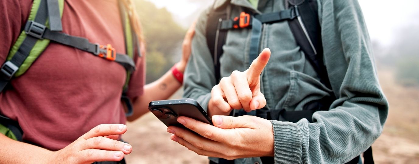
Technology can be incredibly useful when you’re trying to work out where you are, but apps and phones don’t always behave as expected. If you haven’t saved a route or map area in advance and OS Maps isn’t loading or responding:
- If you have signal, try closing and reopening the app.
- If you have no signal, can you safely retrace your steps to somewhere you know you did have a signal and then download the map area or route?
- If your phone is wet, dry the screen and fingers fully for it to respond properly to touch, most touch screens, even on waterproof phones, react to heavy rain and can become very hard to use
- Try sheltering your phone using your jacket or bag long enough to identify your location and which direction to head.
- If the app remains unresponsive, restart your phone if it’s safe to do so.
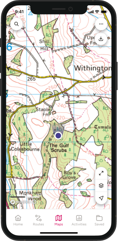
If your maps aren’t loading, try Locate Me
If the map isn’t loading because you’ve lost signal, Locate Me can still work because it uses your phone’s GPS to identify your position, rather than relying on a mobile data connection.
- Click the three dots top right and choose locate me
- You can then swipe between a digital compass and a grid reference
- Give the app a minute to locate you
This can be a useful way to confirm where you are if you’re feeling uncertain and you have a paper map to refer the grid references to.
If you don’t understand grid references just telling mountain rescue the grid reference it shows means they have your exact location.
Don’t be embarrassed to ask Mountain Rescue for help
Too many people worry about “looking silly” or “making a fuss”. In reality, Mountain Rescue teams would generally rather hear from someone while a situation is manageable than after it has developed into an emergency.
If you’re seriously concerned for your safety, call 999 and ask for Police, then Mountain Rescue.
| Situation: | What might happen… |
|---|---|
| It’s getting dark | As daylight fades, navigation becomes harder and familiar landmarks can disappear. A simple mistake can quickly turn into a much bigger problem, leaving you lost, delayed or stranded overnight. |
| Visibility is poor | Fog, low cloud, heavy rain or snow can make it difficult to judge direction and distance. Without knowing exactly where you are, you may drift further off route and into more hazardous terrain. |
| Weather conditions are worsening | Deteriorating weather can quickly increase the risk of exposure and exhaustion. What begins as an uncomfortable situation can develop into an emergency if you are unable to stay warm, dry and safe. |
| You’re cold, wet or extremely tired. | Fatigue and cold can affect judgement, concentration and coordination. As your condition worsens, the chance of navigation errors, trips and falls rises significantly. |
| You’re injured or unwell. | Trying to continue could worsen the injury or illness and make a rescue more difficult. Delaying assistance may mean help becomes harder to access when you need it most. |
| You’re unsure how to get back safely | Continuing without a clear plan can lead to poor decisions, navigating dangerous terrain and increasing disorientation. You may move further from safety and make the situation more difficult to resolve. |
| You’re facing difficult terrain that feels beyond your ability or confidence. | Steep slopes, river crossings or exposed ground can become dangerous when conditions are poor or confidence is low. Pressing on may increase the likelihood of a serious accident. |
| Someone in your group is struggling to continue safely. | A slower pace, injury or deteriorating condition can affect the safety of the whole group. Ignoring the problem may leave everyone exposed to greater risk. |
| You’ve run out of water and feeling dehydrated | Early signs of dehydration include thirst, headache, dizziness, tiredness and difficulty concentrating. As symptoms worsen, judgement, decision making and physical performance can decline, increasing the risk of navigation errors, exhaustion and becoming further lost. |
“A printed OS map, a compass and good navigation skills were the only things that got us safely off the mountain.”
I was out on the Eastern four Munros of the Fannaichs range a few years back. We had a good group who were super keen to bag all nine Munros in a day. But the weather wasn’t on our side. It was spring, and so far north winter was an ever threat to return. Some of the party had literally dressed for a spring day. The forecast was good with potential heavy rain coming in late in the evening.
I was able to use traditional map and compass to quickly plan a route out. It required precision over boulders and constant readjustment. Trying to use the phone to navigate was impossible given the heavy rain.
Common mistakes that make things worse when you’re lost
The NNAS experts we spoke to highlighted several mistakes that repeatedly cause problems.
1. Continuing to walk and hoping it will be fine
Getting further off track with no plan or understanding of your location can make things worse. Stop, stay calm and use all the tools you have available to try and find your way safely back.
As a trainee ML, a group and I were aiming to summit Mayar and Driesh in the Cairngorms. A wrong turn and a heavy dose of complacency later left us on opposite sides of a spur, on a 45+ degree slope, attempting to “take a shortcut” after missing a turn. Fortunately it was summer and the ground was dry, with good weather. The slope aspect was physically challenging and lack of communication and sound decision making left the group split on opposite sides of a spur. The ground lent itself to an inability to communicate and we reached a point of no return before realising the danger we had put ourselves in. We were fortunate to top out, rest, hit one of the summits and laugh about it in hindsight. Georgia Pinson – NNAS Course Director
2. Treating your phone as your only navigation tool
Technology is helpful, but batteries fail, screens get wet and signal can disappear. Multiple instructors identified this as one of the most common problems they see.
Phone batteries chew up when recording Strava, following routes, being a camera. Screens don’t work in a downpour, and you become reliant on an arrow on a screen. If that goes, you’ll not have (or will have lost) any ability to relocate on a paper map and get out of trouble! Fabian Seymour, Winter Mountain Leader & NNAS Provider and Course Director
3. Ignoring worsening weather
Conditions can change far more quickly than forecasts suggest. Several Mountain Leaders described changing or abandoning plans because the reality on the hill was very different from the forecast.
4. Being afraid to turn around
Turning back is often the safest and smartest option.
On a group walk into the Glyderau mountains as a qualified Mountain Leader, myself and group set off from Idwal Cottage with a plan to head up Y Garn following the ridge and do the loop down via Twll Du (Devils Kitchen). The weather forecast was for a mild, wet and windy day, the wind speed wasn’t particularly of concern and not something I hadn’t experienced before. However, on the day within the first couple of hours it was evident that the wind speed was gusting much higher than forecast, making it difficult to stay on our feet. We made a decision to divert and make a shorter day without getting up onto the ridge or summit where conditions would have been unnecessarily risky. A lesson learned that the weather forecast is only a prediction (it may actually be worse/better than expected) understanding this when out on the ground is key in your decision making process. Marty Wall, Winter Mountain Leader and Mountain Rescue volunteer
5. Not calling for help
Asking for help from Mountain Rescue before the situation worsens can save lives and avoid more complex and time consuming rescues.
Want to feel more confident navigating outdoors?
The National Navigation Award Scheme (NNAS) offers navigation courses across the UK, helping walkers develop practical map reading and navigation skills in real outdoor environments.
By Hilary Pullen
Meet Hilary, Editor of OS Maps Discover. Hilary is based in North Wales and loves hiking with her dogs in the mountains of Eryri and Bryniau Clwyd, you can find her on Instagram @nearlyuphill and read her guides to walking in North Wales.
If you would like to be a featured OS Author and write an article or route guide find out more here – how to submit an article idea