Places in the UK Named After the Devil
Britain’s maps are full of places linked to the Devil. From mountain clefts and mysterious standing stones to dramatic valleys and ancient earthworks, generations of storytellers looked at unusual landscapes and imagined supernatural forces at work. Long before geology and archaeology offered explanations, these places inspired legends that have survived for centuries.
This Halloween, we’re following those stories to some of Britain’s most dramatic walking destinations. Each combines fascinating folklore with spectacular scenery, making them ideal places to explore on foot.
Fact or Folklore?
Many devil themed place names emerged as communities tried to explain unusual landscapes. Natural features, ancient monuments and impressive earthworks often became woven into local folklore, with the Devil cast as the creator, destroyer or trickster behind them.
Devil’s Dyke, Sussex
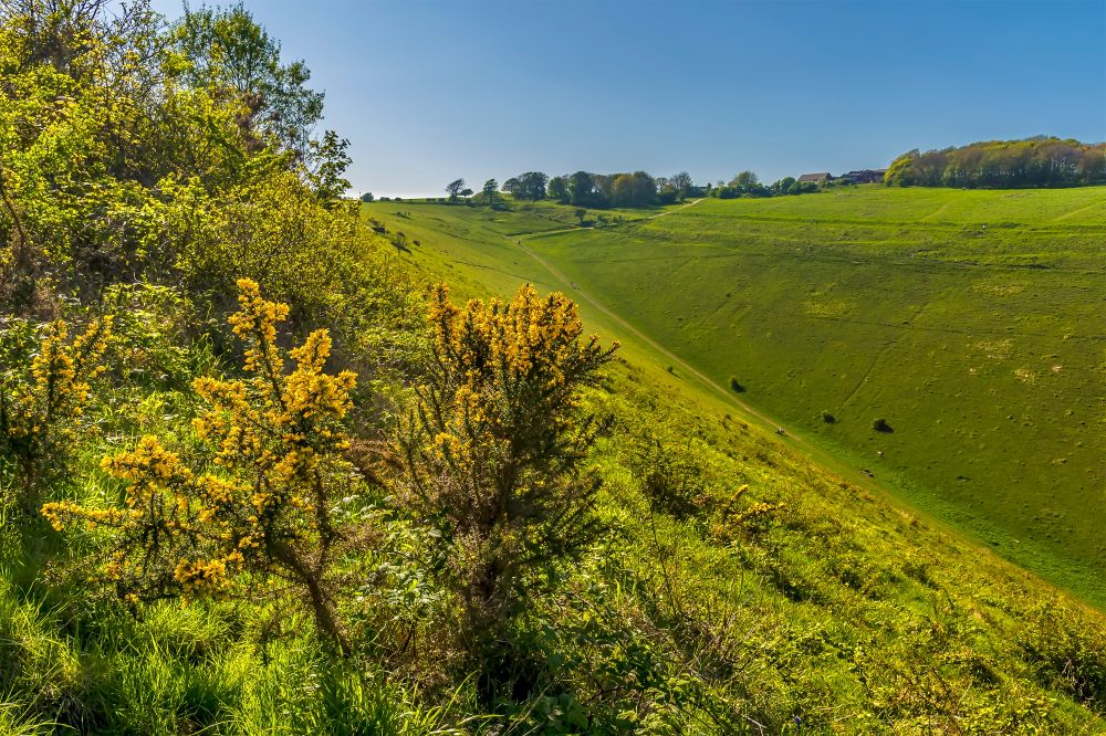
Carved into the northern escarpment of the South Downs, Devil’s Dyke is the longest, deepest and widest dry valley in the UK. The views stretch across the rolling chalk hills of the South Downs National Park and, on a clear day, as far as the Weald.
Legend claims the Devil dug the valley in an attempt to flood the churches of the Sussex Weald. Thankfully for local parishioners, he was interrupted before he could complete the task.
Today it’s one of the South East’s finest walking destinations, with easy access to the South Downs Way and numerous routes across open downland.
Devil’s Kitchen, Eryri
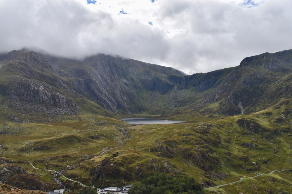
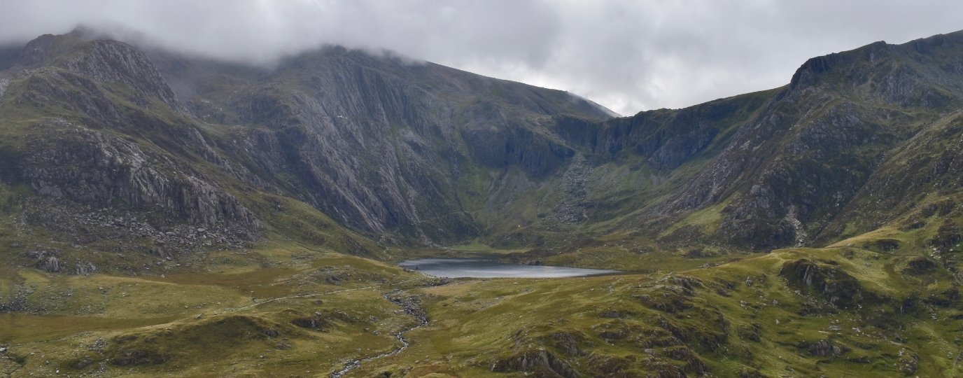
Hidden above the waters of Llyn Idwal, Devil’s Kitchen is one of the most dramatic landmarks in Eryri National Park.
Known in Welsh as Twll Du, meaning “Black Hole”, the deep cleft slices through the cliffs between Glyder Fawr and Y Garn. When mist and cloud spill from the gap, local folklore says it’s smoke rising from the Devil’s kitchen as he cooks beneath the mountains. Don’t worry the path skirts up to the left so you won’t need to climb into this dark and damp cavern.
The reality is no less impressive. Surrounded by glacial cliffs, rocky mountain paths and some of North Wales’ most spectacular scenery, the Devil’s Kitchen remains one of the most atmospheric places to walk in Britain. Add it to a circular walk around Llyn Idwal or do a full circular hike of the magnificent Glyderau.
Devil’s Punch Bowl, Surrey
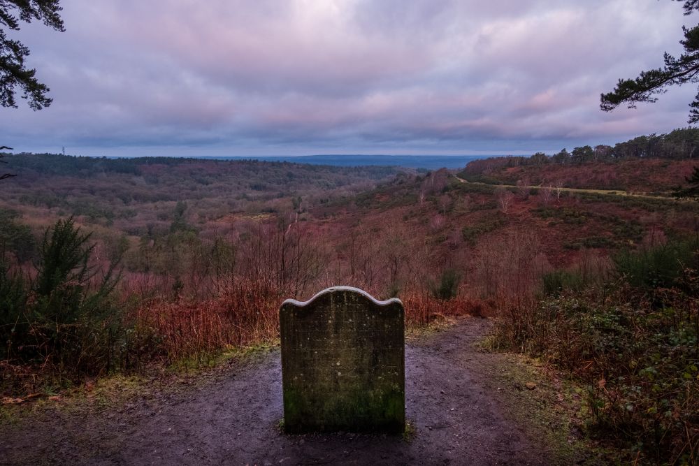
Near Hindhead in Surrey, the Devil’s Punch Bowl forms a vast natural amphitheatre of wooded slopes, heathland and sandstone hills.
Local legends claim the bowl was gouged from the landscape during a battle between the Devil and Thor, while other tales suggest the Devil scooped out the earth himself. Whatever its origins, the result is one of southern England’s most striking landscapes.
Today, a network of well maintained paths allows walkers to explore the rim, descend into the bowl and enjoy far reaching views from nearby Gibbet Hill.
Devil’s Bridge, Ceredigion
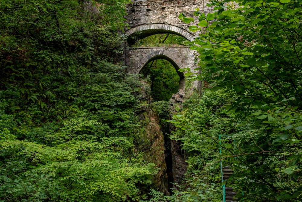
Tucked into a steep wooded gorge in mid Wales, Devil’s Bridge is famous for its dramatic waterfalls and remarkable stacked bridges spanning the Mynach Gorge.
As with many bridges bearing the Devil’s name, local folklore tells of a bargain struck with the Devil to help construct the crossing. Different versions of the story exist, but all end with the Devil being outwitted.
The combination of ancient woodland, rushing water and narrow gorge paths makes this one of Wales’ most atmospheric short walks.
The Devil’s Arrows, North Yorkshire
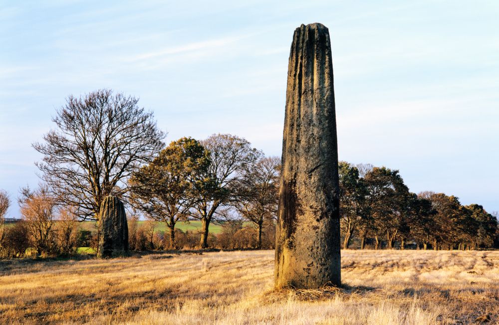
Rising from the fields outside Boroughbridge, the Devil’s Arrows are among the tallest standing stones in Britain. According to legend, the Devil hurled the stones towards nearby Aldborough but missed his target. Their true origins remain prehistoric, though their purpose is still debated today.
They’re a fascinating stop for anyone exploring the Yorkshire countryside and offer a striking reminder of how ancient monuments often became woven into local folklore. We’ve found a great route on OS Maps which also takes in the Roman Ruins at Aldborough, once the capital of Britain’s largest Celtic tribe – the Brigantes.
The Devil’s Beef Tub, Dumfries and Galloway
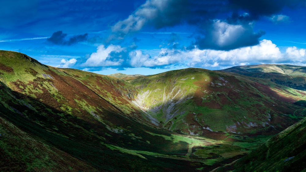
This enormous natural hollow in the Southern Uplands creates one of Scotland’s most eye catching landscapes. Rather than being linked to a supernatural event, the name is thought to originate from Border Reivers who hid stolen cattle within the steep sided basin. Over time, its intimidating appearance helped earn it a sinister reputation.
Today walkers can enjoy sweeping views across the surrounding hills and experience some of the wild character that defines southern Scotland.
Devil’s Point, Cairngorms
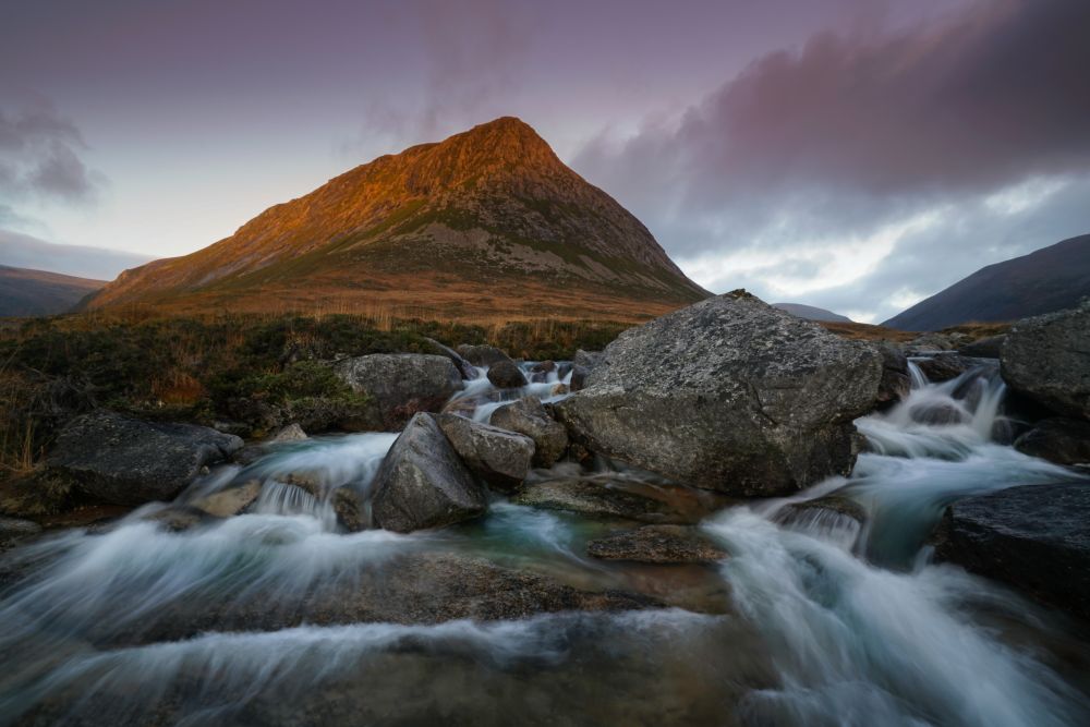
Despite its ominous name, Devil’s Point stands at the heart of one of Scotland’s most spectacular mountain landscapes. Overlooking Loch Muick and surrounded by the vast wilderness of the Cairngorms, the mountain offers a rewarding challenge for experienced hikers.
The summit provides panoramic views across some of Britain’s most remote terrain, proving that devilishly named destinations can be surprisingly beautiful.
Stiperstones and the Devil’s Chair, Shropshire
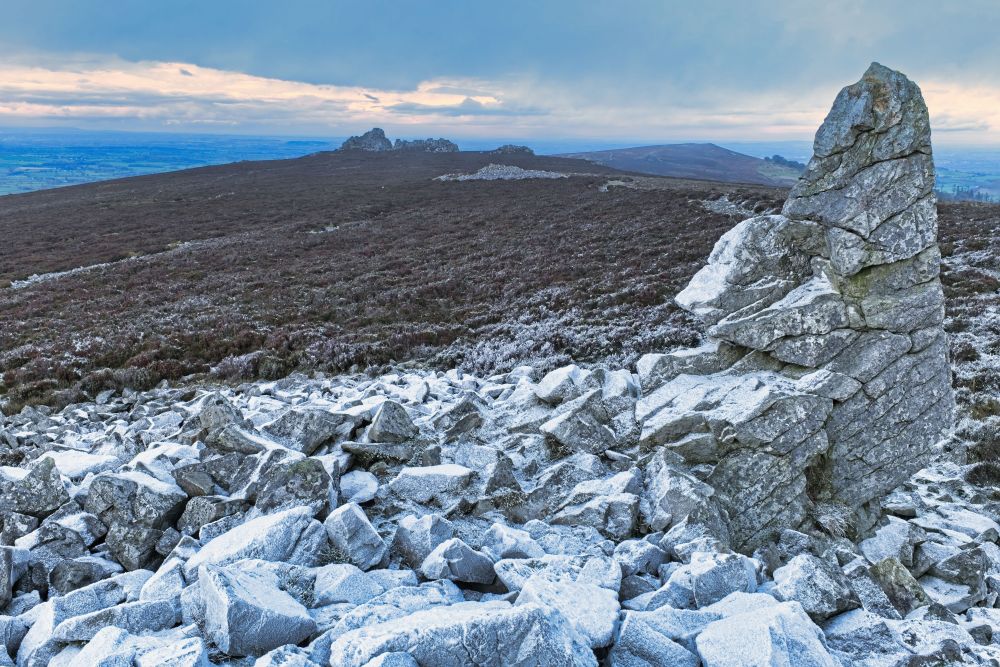
The quartzite ridge of Stiperstones is one of England’s most distinctive landscapes. Its jagged rocky tors crown the ridge like a line of ruined battlements, creating a silhouette that has inspired local myths for centuries. The most famous outcrop, known as the Devil’s Chair, was said to be a favourite perch of the Devil as he surveyed the hills below.
Walking along the ridge feels wonderfully wild and exposed, with far reaching views across the Shropshire Hills National Landscape.
You don’t need a haunted house or a ghost tour to enjoy a spooky adventure this Halloween. Britain’s maps are packed with spookily named places. Pick a route, head outdoors and discover the stories hidden within the landscape.
If Horror Movie Characters Used OS Maps, They’d Probably Still Be Alive
Horror movie characters are famous for bad decisions. This Halloween, we’re exploring the navigation mistakes that might have been avoided with the OS Maps app.

Horror Film Locations in the UK
UK Horror Film Locations: With Halloween around the corner, why not explore some routes passing real-life locations from iconic horror films using Ordnance Survey’s OS Maps?

How to Survive a Zombie Apocalypse (with Maps, Not Apps)
When the undead rise and the internet dies, your survival depends on one thing: knowing how to read a map. Here’s Ordnance Survey’s guide to surviving a zombie apocalypse using traditional navigation skills.
By Hilary Pullen
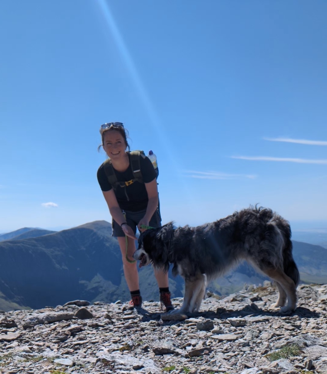
Meet Hilary, Editor of OS Maps Discover. Hilary is based in North Wales and loves hiking with her dogs in the mountains of Eryri and Bryniau Clwyd, you can find her on Instagram @nearlyuphill and read her guides to walking in North Wales.
If you would like to be a featured OS Author and write an article or route guide find out more here – how to submit an article idea