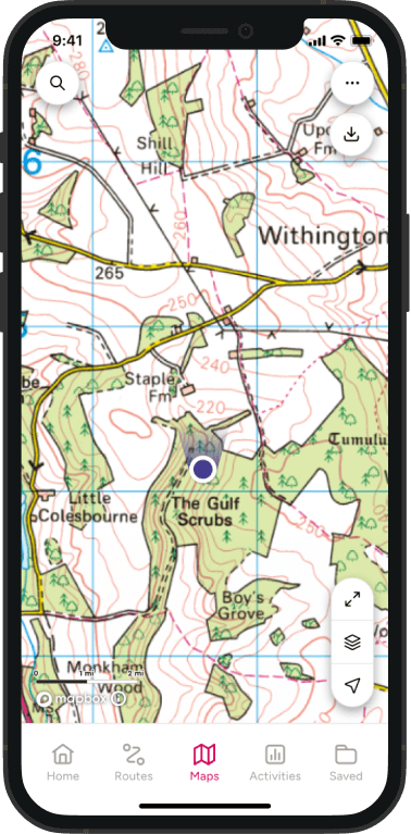

Saxon Shore Way Walk Interactive Map
Looking for a Saxon Shore Way map? Explore the full route on the interactive OS Maps map below and find a full list of the Ordnance Survey paper maps needed for this National Trail equivalent route.
This detailed Saxon Shore Way map follows England’s south east coastline from Gravesend in Kent to Hastings in East Sussex. Use the map to explore key sections, understand the terrain, measure distances and start planning your own long distance walking adventure.
For walkers who prefer paper navigation, OS Explorer maps provide detailed coverage of the entire route.
Saxon Shore Way At A Glance
The Saxon Shore Way is a long distance coastal path following the shoreline of the former Roman Saxon Shore frontier through Kent and East Sussex.
- Distance: 163 miles (262 km)
- Start: Gravesend, Kent
- Finish: Hastings, East Sussex
- Counties: Kent and East Sussex
- National Landscapes: Kent Downs National Landscape (near several sections)
- Highest Point: Approximately 170m near Fairlight Downs
- Typical Duration: 10 to 14 days
- Difficulty: Moderate
- Best For: Coastal walkers, history enthusiasts and long distance walking beginners
- Navigation: OS Maps app and OS Explorer maps
A Journey Through England’s Coastal History
The Saxon Shore Way combines spectacular coastal scenery with nearly two thousand years of history. Following the line of Roman coastal defences built to protect Britain from seaborne raiders, the trail links historic ports, ancient fortifications, nature reserves and some of the most important estuaries in southern England.

The route begins beside the Thames Estuary at Gravesend before weaving through marshland landscapes, historic dockyards and traditional seaside towns. It passes Roman forts at Richborough, Reculver and Lympne, follows the iconic White Cliffs coastline around Dover and Folkestone, and finishes among the dramatic cliffs of Hastings and Fairlight.
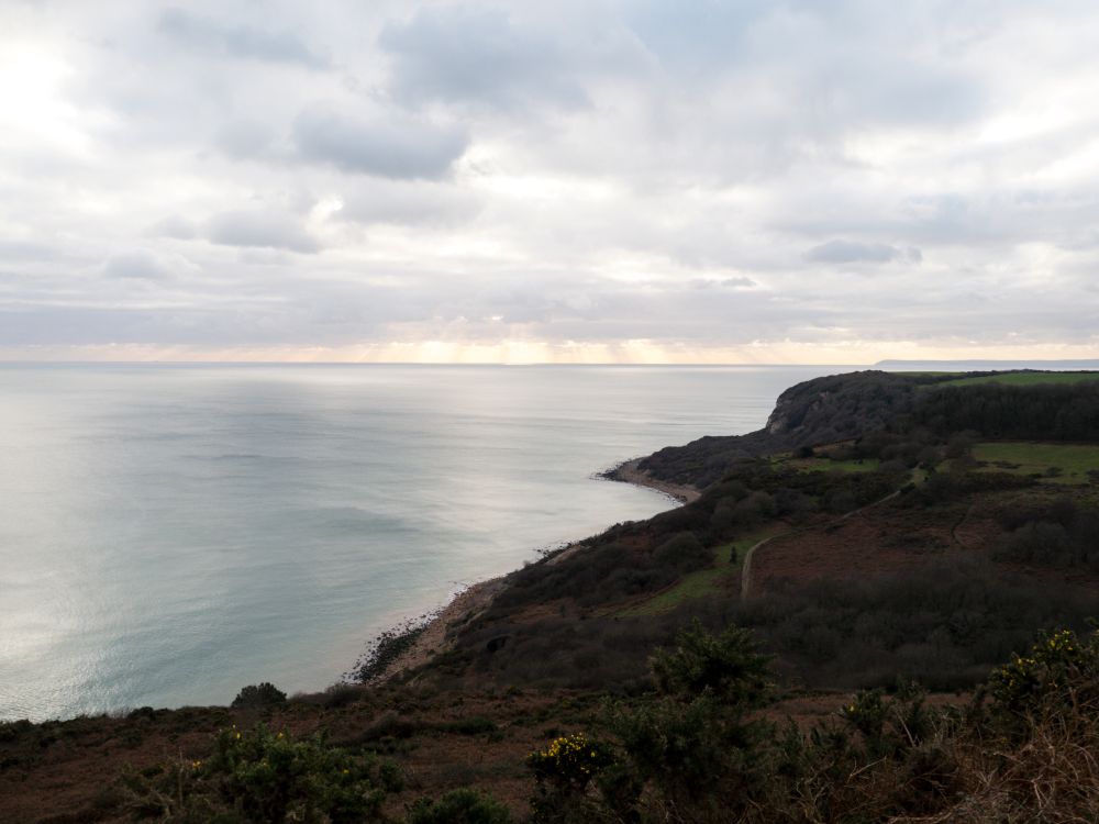
What makes the Saxon Shore Way special is its variety. One day you might be walking through quiet marshes rich with birdlife. The next you could be exploring medieval towns, coastal castles or sweeping cliff top paths with views across the English Channel.
Regardless of if you tackle the route in one journey or enjoy it in shorter sections, the Saxon Shore Way offers a fascinating way to discover the heritage and landscapes of England’s south eastern coast.
Saxon Shore Way FAQs
Why is it called the Saxon Shore Way?
The route follows the coastline defended by a chain of Roman forts known as the Saxon Shore. These forts were built during the late Roman period to protect south east England from raids across the North Sea and English Channel.
Where can I find an online map of the Saxon Shore Way?
You can explore the entire route on OS Maps using the interactive map above. It shows the full journey from Gravesend to Hastings, making it easy to view stages, terrain and nearby facilities while planning your walk.
Premium OS Maps members can also use detailed topographic mapping and 3D Flythroughs to understand key sections of the route.
Is there a single paper map for the Saxon Shore Way?
No. The route covers more than 160 miles of coastline and passes through numerous OS Explorer map areas. Most walkers either use the OS Maps app or carry several Explorer maps covering the sections they plan to walk.
Which Ordnance Survey Maps Do I Need For The Saxon Shore Way?
The route passes through multiple Explorer mapping areas across Kent and East Sussex. Depending on your chosen sections, these may include:
The Saxon Shore Way passes through nine OS Explorer map areas:
- OS Explorer 162: Greenwich and Gravesend
- OS Explorer 163: Gravesend, Rochester and Hoo Peninsula
- OS Explorer 148: Maidstone and the Medway Towns
- OS Explorer 149: Sittingbourne and Faversham
- OS Explorer 150: Canterbury, Isle of Thanet, Herne Bay, Deal and Whitstable
- OS Explorer 138: Dover, Folkestone and Hythe
- OS Explorer 137: Ashford, Headcorn, Chilham and Wye
- OS Explorer 125: Romney Marsh, Rye, Winchelsea, Tenterden and New Romney
- OS Explorer 124: Hastings, Bexhill, Battle and Robertsbridge
Is the Saxon Shore Way available on the OS Maps app?
Yes. The route can be viewed and followed using OS Maps, allowing you to plan stages, discover nearby accommodation and navigate using your phone while walking.
How long is the Saxon Shore Way?
The Saxon Shore Way is approximately 163 miles (262 km) long.
It passes through:
- The Thames Estuary
- Medway towns
- The Swale
- The Isle of Sheppey
- Canterbury
- Thanet
- Dover
- Folkestone
- Romney Marsh
- Rye
- Hastings
Most walkers complete the route in around 10 to 14 days.
Where does the walk start and finish?
The route traditionally starts in Gravesend, Kent, and finishes in Hastings, East Sussex.
Is the Saxon Shore Way difficult?
The route is generally considered moderate in difficulty. Unlike upland National Trails, there are few major climbs, but walkers should be prepared for long distances, exposed coastal weather and sections of muddy marshland paths.
Do I need good navigation skills?
Navigation is generally straightforward, with much of the route following clear rights of way, sea walls and established coastal paths. However, carrying reliable mapping is recommended, especially where the route passes through marshes, farmland and urban areas.
Saxon Shore Way Highlights
Reculver Towers
One of Kent’s most recognisable coastal landmarks, the twin towers of Reculver stand on the site of a Roman fort and offer spectacular views across the north Kent coast.
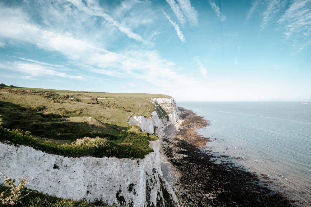
White Cliffs of Dover
Perhaps the most famous stretch of coastline on the route, these iconic chalk cliffs provide dramatic scenery and unforgettable sea views.
Rye Harbour Nature Reserve
An internationally important habitat for migratory birds and coastal wildlife, offering excellent opportunities for wildlife spotting.
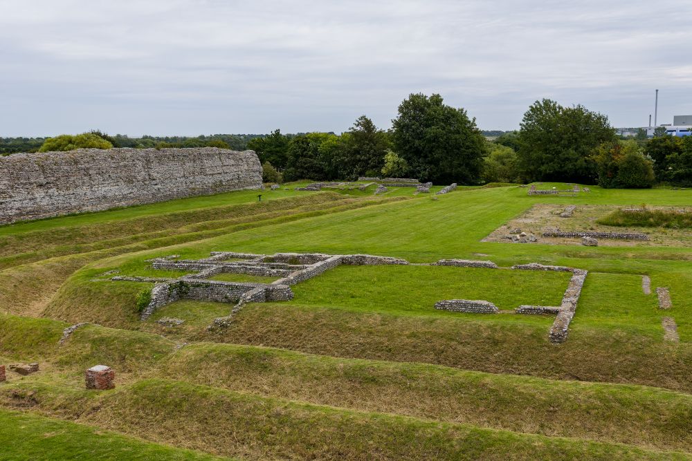
Richborough Roman Fort
One of Britain’s most significant Roman archaeological sites and a key reminder of the route’s historic origins.
Fairlight and Hastings Cliffs
The final stages deliver some of the most dramatic coastal walking in south east England before arriving in historic Hastings.
Planning Your Saxon Shore Way Walk
The free online Saxon Shore Way map above is a great starting point for planning your walk. With a premium OS Maps membership you’ll also get detailed topographic mapping, 3D Flythroughs, offline maps and the ability to print route sections.
Suggested Saxon Shore Way Itinerary
Gravesend to Rochester – 15 miles (24km)
The route begins beside the Thames Estuary before following riverside paths to the historic city of Rochester. Highlights include Rochester Castle and Rochester Cathedral.
Rochester to Sittingbourne – 17 miles (27km)
A mixture of riverside and marshland walking along the Medway Estuary, passing important wildlife habitats and coastal viewpoints.

Sittingbourne to Faversham – 13 miles (21km)
An easier stage crossing the Swale marshes and traditional Kent countryside towards one of England’s best preserved market towns.
Faversham to Canterbury – 16 miles (26km)
Combining coastal heritage with rural landscapes, this section heads inland towards the historic city of Canterbury.
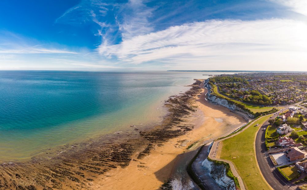
Canterbury to Margate – 18 miles (29km)
A varied stage passing through coastal villages before reaching the beaches and cultural attractions of Margate.
Margate to Ramsgate – 8 miles (13km)
A shorter day featuring classic seaside scenery and easy walking around the Isle of Thanet coastline.

Ramsgate to Dover – 19 miles (31km)
One of the most scenic coastal sections, following cliffs and open sea views towards Dover.
Dover to Folkestone – 9 miles (14km)
A spectacular stretch atop the White Cliffs of Dover, offering some of the best coastal views on the entire route.

Folkestone to Rye – 20 miles (32km)
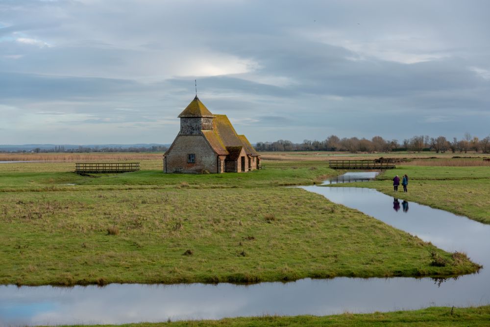
The route leaves the cliffs behind to cross the wide open landscapes of Romney Marsh.
Rye to Hastings – 18 miles (29km)
The final stage combines nature reserves, coastal scenery and dramatic cliff top walking before reaching Hastings.
Ready To Explore The Saxon Shore Way?
Use the Saxon Shore Way map above to start planning your route, discover historic landmarks and prepare for one of England’s most fascinating coastal walks.
From Roman forts and coastal castles to nature reserves and chalk cliffs, the Saxon Shore Way offers a unique long distance walking experience that combines history, wildlife and spectacular coastal scenery.
With trusted Ordnance Survey mapping, you’ll have everything you need to explore with confidence.

Best British long-distance walks
If there’s one thing Britain excels in, it’s long-distance walks. We’ve taken some of the best lesser-known routes from the book, Epic British Walks, to help you plan the hike of your dreams. Find route information and suggestions for day trips.

Hiking for Beginners – A Complete Guide
Hiking for beginners, a complete guide to hiking safety, hiking fitness and the best UK Routes for beginners
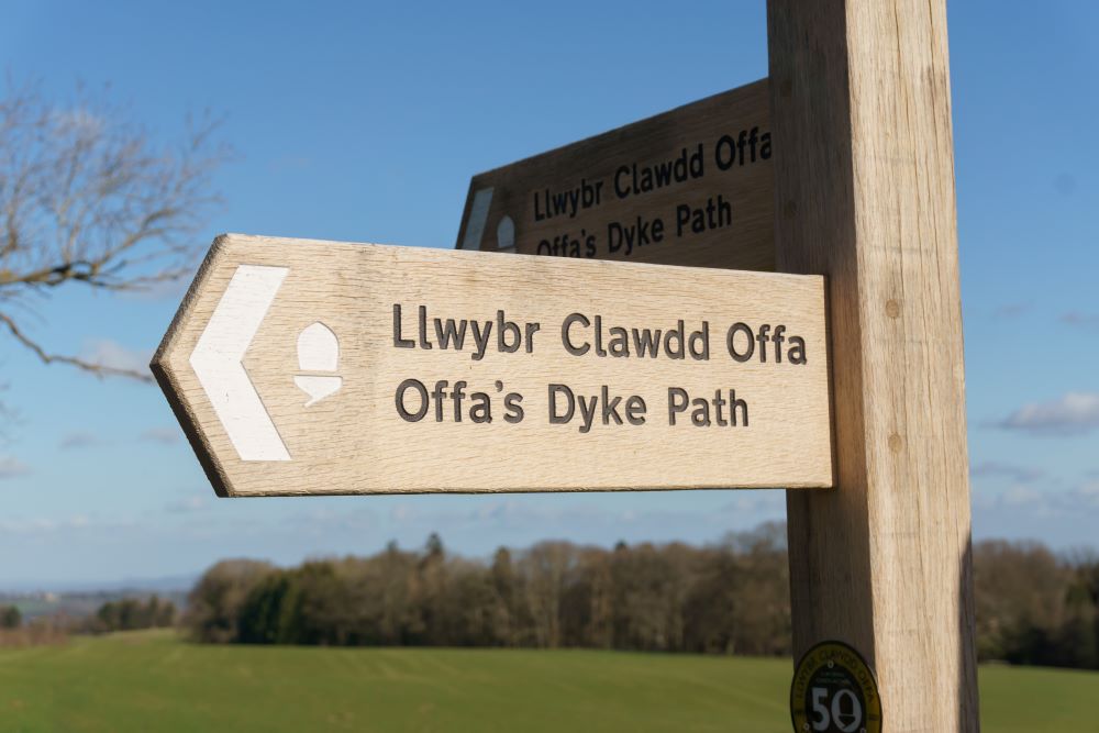
Long Distance Footpaths: Discovering Britain’s ‘Diamond’ trails
How do you find the best footpath? Diamonds on OS maps mark named long-distance routes, highlighting footpaths are truly something special!

By Hilary Pullen
Meet Hilary, Editor of OS Maps Discover. Hilary is based in North Wales and loves hiking with her dogs in the mountains of Eryri and Bryniau Clwyd, you can find her on Instagram @nearlyuphill and read her guides to walking in North Wales.
If you would like to be a featured OS Author and write an article or route guide find out more here – how to submit an article idea